

Hiking Trails in Kentucky: Caves, Cliffs & Incredible Views
Kentucky’s hiking trails wind past sandstone arches and forested gorges, through cave country, and along river bluffs with wide-open views. You’ll find routes for a brief scenic walk, a full day on the trail, or a longer backcountry adventure.
Choosing the right hiking trail means weighing more than mileage. Terrain, elevation, weather, and access rules can all shape your day, so this guide will help you find a route that fits your plans, know what to expect, and prepare for a safe visit. Be sure to check out the RunDreamAchieve YouTube channel for weekly running tips.
Key Takeaways
- Kentucky’s hiking options suit different experience levels, from short scenic walks to longer outings. Choose a route based on your fitness, available time, and comfort with uneven terrain.
- Expect varied scenery, including sandstone arches, forested gorges, cave-country landscapes, and river bluffs, so the setting can shape your choice as much as mileage.
- Before setting out, check distance, elevation, trail conditions, weather, parking, and access rules. These details can change the effort and timing of a hike.
- Compare official routes through Kentucky State Parks’ trail listings, then carry a map and enough water for your chosen hike.
- Start with a manageable distance, leave room for breaks, and adjust plans if weather or trail conditions make the route less safe.
Hiking Trails in Kentucky: Four Destinations Worth the Trip
Kentucky’s hiking trails suit different plans, whether you want a short walk to a landmark or a longer route over rugged terrain. These four destinations offer distinct scenery, so choose by trail difficulty, available time, and the kind of landscape you want to explore.
Red River Gorge for sandstone arches and rugged routes
In Daniel Boone National Forest, Red River Gorge pairs forested ravines with sandstone cliffs, natural arches, and overlooks. The Auxier Ridge and Gray’s Arch areas are popular starting points, but route lengths and difficulty vary. Some trails include steep climbs, rocky footing, or exposed overlooks, so check the route details before setting out.
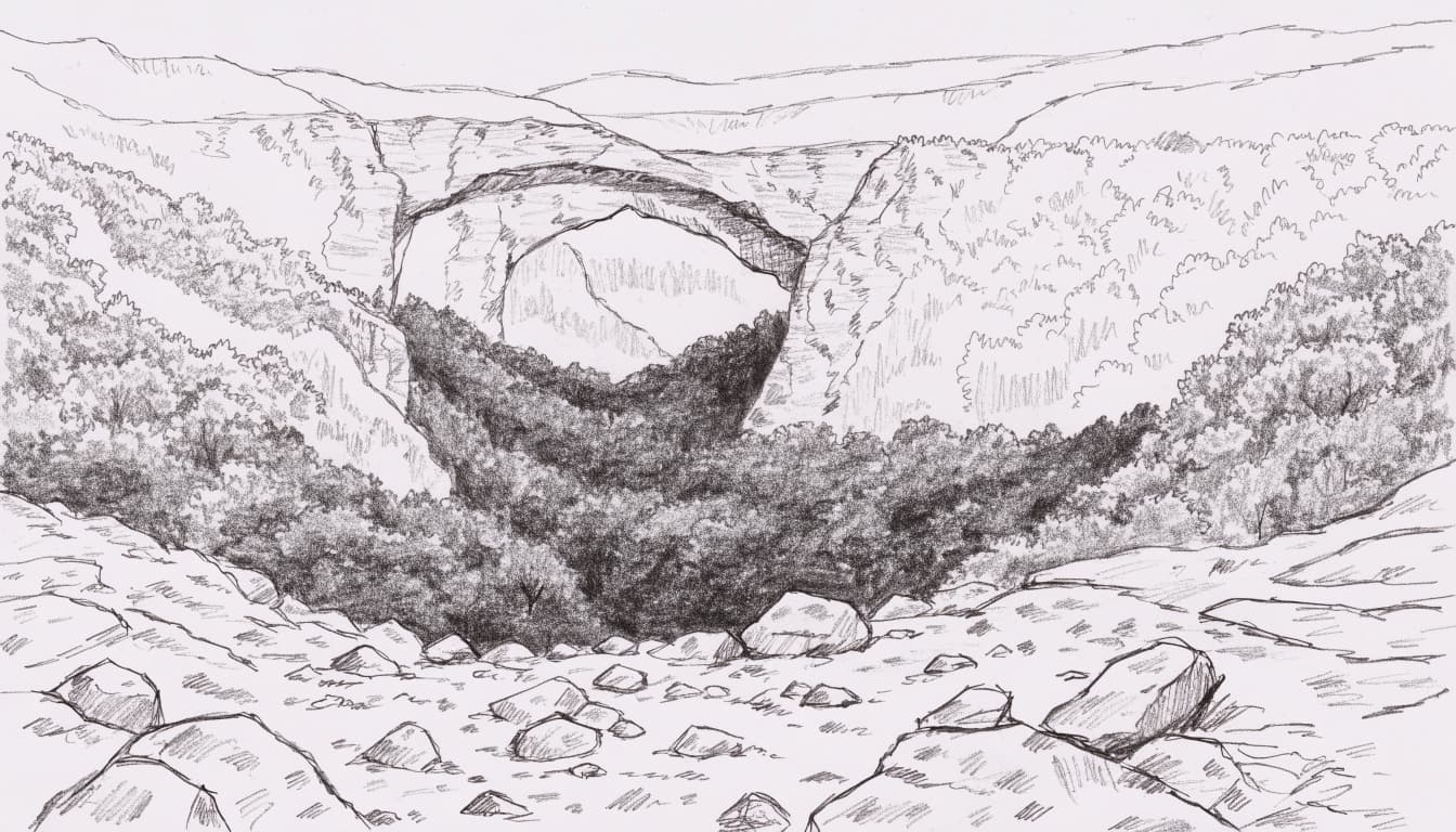
Parking, permits, and access rules can differ by trailhead and activity. Check the Forest Service’s Red River Gorge information before you go, especially if your plans include backcountry travel or camping.
Mammoth Cave for shaded forest and underground wonder
Mammoth Cave National Park offers plenty to explore above ground, including forest paths, sinkholes, and historic landscapes. Cedar Sink and the Green River Bluffs area give hikers different ways to experience the park’s surface terrain. The National Park Service lists more than 80 miles of trails across the park, with options for varied outing lengths.
Cave tours are separate from surface hikes and need their own planning. Tour availability and reservation requirements may change, so check current details before building a visit around an underground tour. The park’s visitor center and south-side trail guide helps you compare routes.
Cumberland Falls and Big South Fork for water and wide views
At Cumberland Falls State Resort Park, forest paths lead toward the river and the park’s namesake waterfall. Short routes offer scenic stops, while longer trails provide more time on wooded terrain. The park’s hiking trail information can help you choose a route that fits your day.
Big South Fork National River and Recreation Area offers a different feel, with sandstone cliffs, river overlooks, and backcountry routes. In both areas, distance alone doesn’t tell the whole story. Wet rock near water and steep sections can make even a short hike more demanding, so wear suitable shoes and take care on uneven ground.
Natural Bridge and Land Between the Lakes for different kinds of scenery
Natural Bridge State Resort Park rewards hikers with a stone arch reached by climbing forested trails. The uphill effort and rocky sections may suit hikers comfortable with a more strenuous walk; shorter approaches are also available. Review the park’s Natural Bridge trail information to match your route to your ability.
Land Between the Lakes offers quieter lakeside forests, wildlife habitat, and a broad network of trails. Some routes are shared with cyclists or horseback riders, so check local maps and rules before starting. Across these destinations, a current site map and a realistic look at the terrain can help you choose a hike you’ll enjoy.
Choose a Kentucky hike that fits your time and fitness
The best hike is one that matches your energy, schedule, and interest in the scenery. A short route can still feel strenuous if it climbs sharply or crosses loose rock, while a longer, gradual trail may feel more comfortable. Check the route, elevation gain, surface, and current conditions before choosing.
Easy walks for families and first-time hikers
Beginner-friendly hikes usually have clear wayfinding, manageable distances, and steady footing. Short nature trails and scenic loops at state parks or national recreation areas can offer a rewarding outing without committing to a full day. Nearby facilities, such as restrooms or a visitor center, may also make the trip easier to plan, though availability varies by location.
With children, plan around their pace rather than an adult estimate. Allow time for stops, bring water, and look for shaded routes during warm weather. Before you start, choose a turnaround point so everyone knows when to head back, even if the group hasn’t reached the route’s end. A shorter hike with time to notice wildlife and enjoy the view often makes a better first experience than a longer walk that leaves the family tired.
Choose Your Distance, Duration and Goal Time
Make three quick selections and open the exact plan built for your race target.
Looking for a Fully Personalized Training Plan?
The training plans above are an excellent choice if they match your goal. However, if you’d rather train with a plan built specifically around your current fitness, goal race, preferred training days, weekly mileage, and target finish time, our RDA Custom Training Plans provide a personalized solution. We also have running courses available for runners seeking to run faster from the mile to the marathon.
Why Choose a Custom Training Plan?
| Standard Training Plan | RDA Custom Training Plan |
|---|---|
| Follows a fixed schedule | Built around your schedule |
| Standard weekly mileage | Peak mileage customized for you |
| Fixed workout days | Train on the days you choose |
| Same structure for everyone | Designed around your current fitness |
| Static plan | Updated as your fitness improves |
| One-time purchase | Ongoing personalized coaching and support |
What You’ll Receive
- A training plan built specifically for your goal
- Personalized training paces
- Long runs, tempo runs, threshold workouts, interval sessions, recovery runs, and easy runs
- Peak weekly mileage matched to your experience level
- Flexible training schedule that fits your life
- Ongoing plan adjustments as your fitness improves
Ready to Train Smarter?
Stop guessing and start following a plan built specifically for you, your schedule, and your racing goals.
Moderate hikes with overlooks, arches, and waterfalls
Rolling climbs can add effort, especially when roots, rocks, or muddy stretches slow your pace. Check elevation gain as well as mileage: a short route with a steep ascent may demand more than a longer trail with gentler grades. After rain, slick surfaces can make descents harder, so leave extra time and wear shoes with reliable traction.
The Red River Gorge, Natural Bridge, and Cumberland Falls areas offer hikes with varied scenery, but difficulty differs from trail to trail. One route may lead to an overlook with a sustained climb; another nearby may be shorter or less rugged. Compare individual route details before deciding, and use Red River Gorge and Natural Bridge trail maps to help plan where to start.
Long-distance routes for a bigger challenge
For a multi-day goal, the Sheltowee Trace runs through eastern Kentucky and connects a range of forest and backcountry settings. You don’t have to hike the entire route. Choosing one section lets you set a distance and schedule that fit your experience, available days, and transportation.
The Forest Service’s Sheltowee Trace information can help you begin researching access and route details. Before leaving, plan where you’ll refill water and carry enough food for the full outing, plus a reserve in case travel takes longer than expected. Bring a reliable map and navigation method, and arrange transport at both ends if your chosen section doesn’t form a loop.
Overnight hikers also need to confirm where camping is allowed and what rules apply. Conditions, access, and regulations can change, so check current notices before setting out. With the route and logistics settled in advance, you can focus on the trail rather than solving transport or supply problems along the way.
When to hike Kentucky’s trails and what each season brings
Kentucky’s trails change with the weather, and each season brings a different mix of comfort, scenery, and trail conditions. Spring and fall often offer the most comfortable hiking, while summer heat and winter exposure call for more careful planning.
Spring and fall bring mild days and changing trail conditions
Spring brings wildflowers, fresh leaves, and streams swollen by seasonal rain. However, wet weather can leave dirt paths muddy and rocks slick, especially in wooded gorges and near waterfalls. Check the forecast before leaving, and allow extra time if rain has passed through. Shoes with dependable traction help on uneven or damp surfaces.
Fall offers cooler hiking weather and colorful foliage across the state. Kentucky’s state parks fall foliage guide highlights the season’s changing leaves, while the Kentucky foliage map can help you plan around regional color. Timing varies by location and year, so check conditions close to your visit rather than expecting peak color on a fixed date.
Popular destinations can draw more visitors during autumn, particularly on weekends. Arrive early when possible, and remember that shorter days leave less time for a long route. In either season, pack a light layer and a rain shell; temperatures and conditions can shift during the day.
Summer heat and winter weather call for extra planning
Kentucky summers can bring high humidity and strong sun, especially on exposed ridges and overlooks. Start early to avoid the warmest part of the day, carry more water than you expect to need, and wear sun protection. Take breaks in shaded spots, and shorten the route if heat makes the hike feel harder than planned.
Winter hikes can be peaceful, but cold, wind, and ice change the effort and risk. Exposed overlooks may feel much colder than sheltered forest trails, while icy rock or packed snow can make footing unreliable. Daylight is also shorter, so leave early and choose a route that leaves enough time to return before dark.
Conditions vary across Kentucky, including between lower valleys and higher elevations. Check the forecast for your specific destination, then adjust clothing, water, and route plans to match. Carry layers in any season, since a comfortable start does not guarantee comfortable conditions on an exposed or shaded stretch.
Plan a smooth, safe hiking trip in Kentucky
A rewarding day on Kentucky’s trails starts before you reach the trailhead. A little planning helps you avoid access surprises, carry what the route demands, and make sound decisions when the weather or terrain changes.
Check trail maps, closures, permits, and parking before you go
Use a current map from the official park or forest managing your destination. Then check alerts shortly before departure, since storms, maintenance, or other hazards can close a trail or change access. The Daniel Boone National Forest alerts page, for example, posts current notices for the forest.
Access rules vary by location. Some trailheads or activities may require a permit or fee, and parking can be limited, especially at popular sites. Review the area’s pass and fee information, and confirm whether your specific hike requires anything beyond a parking space.
Before leaving home, save an offline map in case cell service drops. Pin the correct trailhead, check the route’s total distance and elevation, and note where you plan to turn around. If you’re hiking a one-way route, arrange transportation at both ends. Share your route and expected return time with someone who isn’t joining you.
Pack for rocky terrain, changing weather, and limited services
Kentucky’s trails can shift from smooth paths to exposed roots, loose rock, and steep footing. Wear supportive footwear with traction, and bring enough water and snacks for the route, pace, weather, and time outside. There isn’t one water amount that fits every hike, so plan for your conditions and carry a reserve when the route is remote.
A compact first-aid kit, weather-appropriate layers, and a headlamp belong in your pack, even on a day hike. A charged phone can help with navigation, but don’t rely on it as your only tool. Cell service may be limited in backcountry areas, so carry an offline map or another dependable navigation option. The National Park Service’s hiking safety guide also recommends carrying essentials such as food and water and staying on your intended route.
Protect yourself and the places you came to enjoy
Stay on marked paths, follow posted instructions, and let someone know your plan before you set out. Near cliffs, waterfalls, and river edges, keep a safe distance from drop-offs and wet rock. If weather worsens, daylight runs short, or anyone in your group feels unwell, turn back while you still have time and energy.
Practice Leave No Trace by packing out trash, keeping noise low, and leaving plants, rocks, and historic objects where you find them. Give wildlife room, never feed animals, and keep dogs controlled where they are allowed. Rules differ by site, so check local guidance before bringing a pet or planning a fire or overnight camp. The Leave No Trace principles offer practical guidance for reducing your impact.
Frequently Asked Questions
A few practical details can make it easier to choose among hiking trails in Kentucky. Use these answers to narrow your options, then check the latest information for your specific destination before heading out.
What is the best hiking trail in Kentucky for a first visit?
The best choice depends on your fitness, available time, and the scenery you want. For a manageable first outing, consider a shorter route in Mammoth Cave National Park’s Green River Bluffs area, where wooded trails offer scenic views without requiring a long-distance hike. Check the official south-side trail guide for route options and current maps, then pick a distance that leaves time for breaks.
Are there free hiking trails in Kentucky?
Yes. Many Kentucky trails are free to access, and Mammoth Cave National Park does not charge an entrance fee for its surface areas. However, fees can apply at some parks, trailheads, or recreation areas, including charges for parking or other services. Before you travel, check the specific destination’s current fees and passes and any posted access notices.
Can beginners hike in Red River Gorge?
Beginners can hike in Red River Gorge, but they should choose carefully. The area includes steep climbs, rocky footing, confusing junctions, and exposed cliff edges, so start with a short route that appears clearly on a current map. Carry an offline map or another reliable navigation tool, follow marked paths, and keep a safe distance from drop-offs, even when an overlook seems easy to reach.
Are dogs allowed on Kentucky hiking trails?
Dog rules vary by park, trail, and facility. Some trails allow leashed dogs, while cave sites and protected areas may restrict pets; for example, Natural Bridge State Resort Park’s trail rules do not allow dogs on its hiking trails. Check local rules before you go, leash your dog where required, and pack out pet waste.
How long is the Sheltowee Trace?
The Sheltowee Trace runs for hundreds of miles through eastern Kentucky, and its route length can change as sections are updated. The trail association lists the official distance as 343 miles for 2025 on its thru-hiker information page. Before planning a thru-hike or section hike, check current trail information and maps, since access points and route details may have changed.
Conclusion
Hiking trails in Kentucky offer a route for nearly every kind of day, whether you’re looking for a brief forest walk or a rugged backcountry challenge. The best hike is one that matches your ability, schedule, and comfort with the terrain.
Before you head out, check current trail conditions, weather, and access rules. Pack for the route, leave enough time to return, and follow local guidance along the way.
Then leave the trail as you found it, with plants, rocks, and wildlife undisturbed. A thoughtful plan helps keep Kentucky’s natural places ready for the next hiker.


