Vienna Marathon Map: Course, Landmarks & Aid Stations
Runners search for a Vienna marathon map to answer practical race-day questions: What does the course look like, where are the aid stations, and which roads will be closed? A clear route overview also helps you plan transportation, choose spectator viewing spots, and prepare for the race’s major landmarks and turns.
Keep in mind that the Vienna City Marathon route can change by race year, so compare any map you find with the latest official race information before making plans. This guide explains the course layout, elevation, race strategy, road closures, spectator logistics, and simple map-reading tips that can help you arrive prepared.
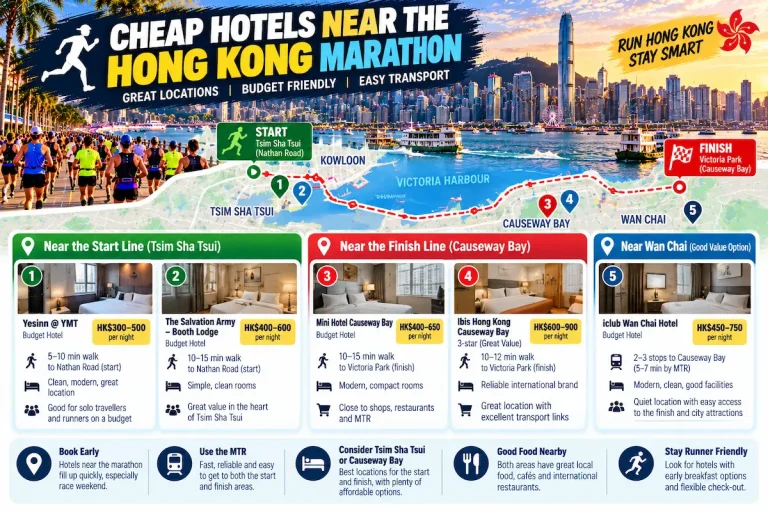
Start by getting familiar with the route and its key landmarks. Looking for the best hotels for the Vienna marathon? Make sure to reserve your rooms early.
Key Takeaways
- Check the latest Vienna marathon map because the route, aid stations, and road closures can change by race year.
- Use major landmarks, including Schönbrunn Palace, the Ringstrasse, and Prater, to understand the course and plan spectator viewing.
- Review aid station locations before race day, then decide where you’ll take water, sports drink, and any nutrition.
- Study public transportation changes and nearby stations, since closures can affect both runners and supporters.
- Split the course into manageable sections, saving energy for the final kilometers and the finish near the city center.
Vienna Marathon Map: What the Course Shows at a Glance
A Vienna marathon map gives you more than a line through the city. It shows how the race moves between open riverside roads, historic districts, major landmarks, and support points. Before traveling, download the current official map or check the race app, because the route, start waves, aid stations, and road crossings can differ by year.
Where the Vienna City Marathon Starts and Finishes
The start area is typically near the Danube, with the Reichsbrücke and surrounding roads helping organize runners before the race begins. On the map, find your assigned start corral, then locate the bag drop, toilets, warm-up area, and the pedestrian route from nearby public transit stops. Corral colors or wave numbers should match your race instructions.
The finish usually brings runners back toward central Vienna. Look for the final kilometer, finish chute, medal collection, bag pickup, medical point, and designated meeting areas. A map may show these facilities with icons rather than full labels, so check the legend before race morning.
Study the distance between transit stops, the start area, and the finish. The route may be easy to follow for runners but less direct for spectators, especially when roads close. After finishing, you may need to walk several blocks before reaching an open station or meeting point. Choose a rendezvous location outside the busiest finish zone, and share it with your group in advance.
The official course map should also identify:
- Kilometer markers and timing mats, including intermediate timing points.
- Water, sports drink, nutrition, toilet, and medical stations.
- Major road crossings, turns, and sections shared with relay or shorter races.
- Restricted areas that runners and spectators cannot cross during the event.
The Main Landmarks Along the Marathon Route
Use Vienna’s landmarks as mental checkpoints rather than relying only on street names. The Danube and Reichsbrücke usually help you understand the opening section, while the Prater and its long Hauptallee can make the course feel more open and spacious. The wide avenue may also help you judge your position within a group.
As the route moves toward central Vienna, the Ringstrasse and historic streets create a noticeable change in scenery. Depending on the selected race year, the course may pass near the Hofburg, Burgtheater, or other central landmarks. Check their order on the current Vienna marathon map, since route changes can shift both the sequence and the distance between them.
These landmarks help divide the race into manageable sections. Pair each one with the nearest kilometer marker, aid station, or timing mat, then confirm the details in the official race app before race morning.
How to Read the Vienna Marathon Course Before Race Day
A Vienna marathon map becomes useful when you turn its symbols and lines into a race plan. Check the legend, scale, kilometer markers, course direction, elevation details, aid stations, toilets, medical points, and timing mats. Then review the route on both your phone and a larger screen so small turns and labels don’t disappear.
Check Distance, Elevation, Turns, and Surface Changes
Study the course in segments instead of treating it as one long line. Break it into landmarks or five-kilometer blocks, then note where you expect to settle into pace, manage effort, or conserve energy. A flat-looking urban course can still feel difficult because bridges, tight turns, wind, crowds, and late-race fatigue change how the kilometers feel.
Look for bridges, exposed stretches beside the Danube, long straight roads, and corners that may slow a large pack. Check whether the current route includes cobblestones or other uneven surfaces, especially near historic streets. Mark sections where runners may bunch up, lose rhythm, or need extra room to pass.
Use the elevation profile as a guide, but don’t trust an old chart automatically. The official route may change between race years, and a third-party map may show a previous course. Compare every detail with the latest race guide and official Vienna marathon map before setting pace targets.
Find Water Stations, Toilets, Medical Help, and Timing Mats
Aid stations affect both pacing and fueling. Decide in advance where you’ll drink, take a gel, slow down safely, or move toward medical help. Station spacing and available supplies can change, so read the current race guide and carry any nutrition you depend on.
Plan toilet use before the start, then identify course toilets in case you need one later. Medical stations may use different icons or colored symbols, so check the map legend and remember how volunteers or signs identify them. Timing mats also help you understand where split times are recorded and where spectators may track your progress.
Use a Digital Route Map Without Losing Your Bearings
Use the official website, race app, or official GPX file to study the route. A mapping app can help you inspect turns and nearby streets, but it shouldn’t replace course signs, volunteers, or the race briefing on event morning.
Save an offline copy of the map and check your phone’s battery, data access, roaming settings, and screen readability. Review the route on a larger screen first, then use your phone for quick reference. Also adjust privacy settings if a mapping app records your location.
Finally, add personal meeting points away from the busiest finish area. Choose a fixed landmark that remains accessible after road closures, and share it with your supporters before race day.
The Route in Sections: What Runners Can Expect Across Vienna
The Vienna marathon course moves through several distinct city zones, and each one creates different pacing and navigation challenges. Use these sections to build a mental route, then confirm the exact streets, kilometer ranges, aid stations, and turns on the current official Vienna marathon map.
The Opening Miles Near the Danube and Reichsbrücke
The start can feel crowded and electric, especially around the corrals, bridges, and broad roads near the Danube. Thousands of runners need time to spread out, so the first kilometers may include sudden slowdowns and limited room to pass.
Start conservatively. Avoid weaving through the pack, because every sharp move costs energy and can disrupt your planned pace. Let the crowd settle while you find a comfortable rhythm instead of chasing a fast opening split.
An exposed bridge or riverfront stretch may bring wind, direct sun, or a noticeable temperature change. Keep your effort steady and use your breathing as a guide. The early goal is to reach the next course zone feeling controlled, not to bank time.
The Prater Section and Its Long, Straight Roads
The Prater section can offer space to settle into an even pace, particularly on long, straight roads. That openness also makes the distance feel more demanding because fewer turns break up the view.
Use course markers, landmarks, and effort to stay focused. Checking your watch every few seconds can create tension and encourage small pace changes. Instead, review your split at planned points and judge whether your effort still feels sustainable.
Shade, pavement conditions, crowd support, and aid station placement can change how this section feels. The current official map should confirm the exact route, station locations, and kilometer markers for your race year. Take fluids without stopping in the center of the road, and move predictably when passing other runners.
Central Vienna Landmarks and the Historic City Center
The central section often brings louder crowds and memorable views, but denser streets can make it harder to hold a perfect racing line. Turns may arrive more frequently, and runners may bunch near barriers, landmarks, or aid stations.
The Ringstrasse, Hofburg, Burgtheater, and other historic sights are useful orientation points only when they appear on the current course. Check their order and approximate kilometer positions before race day, since Vienna Marathon routes can change between editions.
If you pass a landmark worth photographing, keep moving unless you have a safe stopping area. Never stop suddenly in front of another runner. Follow race instructions about staying left or right, especially when faster runners need room to pass.
The Late Miles and the Final Approach to the Finish
Middle-to-late course sections can feel longer than expected as fatigue builds. Keep fueling before hunger or weakness becomes urgent, and shorten your pace goal if your effort starts rising sharply.
Use the map to see how far remains after the last major landmark. The final turns, finish chute, medal collection, bag pickup, and family meeting area all affect your post-race plan. Study that flow beforehand so you can finish without wondering where to go next.
Plan Race Day Around the Vienna Marathon Map
Your Vienna marathon map should guide more than your pacing. Use it to connect your hotel, transportation, start corral, spectator locations, and post-race meeting point. Large races can affect buses, trams, subway entrances, bridges, and central roads, so check current transit notices and the organizer’s race-day instructions before leaving your hotel.
Choose a Hotel and Transit Plan That Matches Your Start
Compare hotels by their access to the start area, not only by price or proximity to the finish. Check the walking distance to an operating subway or tram stop, breakfast hours, luggage storage, and your options for returning after the race.
A hotel near the finish may still require a separate trip to the start. The shortest route on a normal city map may pass through a closed street, restricted bridge, or controlled race zone on marathon morning. Plan a primary route and a backup route, then allow extra time for security checks, crowd movement, and walking between transit stops and corrals.
A practical morning timeline might look like this:
- Wake early enough to eat, dress, and use the restroom without rushing.
- Leave with time for a transit delay or a longer walk around barriers.
- Reach the start area before your required corral entry time.
- After finishing, follow the signed exit route before heading to your hotel or meeting point.
Treat these times as planning points, not an official schedule. The current race guide determines the actual start, entry, and bag-drop requirements.
Create a Spectator Plan With Easy Meeting Points
Spectators should choose one or two viewing locations instead of trying to follow the runner across Vienna. Use the course map to find a landmark near an accessible street, transit stop, or open crossing. A clear meeting point outside the busiest finish zone is usually easier than searching near the finish chute.
Estimate arrival times using the runner’s realistic race pace. A goal pace may not account for crowded opening kilometers, aid stations, hills, weather, or brief toilet stops. Share the runner’s bib number and expected time range, then select a backup meeting point if the first location becomes crowded.
Before race day, confirm whether the street, bridge, or transit stop is open to spectators. Race barriers can separate two locations that look close on the map. Your backup point should have a distinct landmark and enough space for people to wait safely.
Choose Your Distance, Duration and Goal Time
Make three quick selections and open the exact plan built for your race target.
Looking for a Fully Personalized Training Plan?
The training plans above are an excellent choice if they match your goal. However, if you’d rather train with a plan built specifically around your current fitness, goal race, preferred training days, weekly mileage, and target finish time, our RDA Custom Training Plans provide a personalized solution. We also have running courses available for runners seeking to run faster from the mile to the marathon.
Why Choose a Custom Training Plan?
| Standard Training Plan | RDA Custom Training Plan |
|---|---|
| Follows a fixed schedule | Built around your schedule |
| Standard weekly mileage | Peak mileage customized for you |
| Fixed workout days | Train on the days you choose |
| Same structure for everyone | Designed around your current fitness |
| Static plan | Updated as your fitness improves |
| One-time purchase | Ongoing personalized coaching and support |
What You’ll Receive
- A training plan built specifically for your goal
- Personalized training paces
- Long runs, tempo runs, threshold workouts, interval sessions, recovery runs, and easy runs
- Peak weekly mileage matched to your experience level
- Flexible training schedule that fits your life
- Ongoing plan adjustments as your fitness improves
Ready to Train Smarter?
Stop guessing and start following a plan built specifically for you, your schedule, and your racing goals.
Prepare for Weather, Crowds, and Race-Day Restrictions
Check the forecast close to race day and adjust clothing, hydration, and pacing. Cool temperatures can make the start uncomfortable, while sun exposure, rain, or wind on open roads can change how quickly you use fluids and energy.
Aid stations may become crowded, and restroom access can be limited. Follow volunteer directions, respect barriers, and avoid stopping in narrow areas or directly after a station. Keep moving until you reach a safe place to adjust clothing, take nutrition, or check your map. Always defer to the current race guide for road restrictions, transport changes, and course rules.
Use the Map to Build a Smarter Vienna Marathon Strategy
A Vienna marathon map can shape your race plan before you arrive at the start. Divide the route into early, middle, and late goals, then connect each phase to landmarks, kilometer markers, aid stations, and effort checks.
Set Pace Targets for a Mostly Urban Course
Your goal pace is the average speed you hope to maintain for the full marathon. Your actual pace is what your watch records during the race, while easy effort describes how hard running feels in your body. Those numbers won’t always match on race day.
Open with control, especially near the start, bridges, and crowded streets. During the middle section, settle into a steady effort rather than chasing every fast or slow split. Keep the final phase flexible. If you feel strong, gradually increase your effort; if fatigue, heat, or wind builds, protect your form and finish safely.
Turns, congestion, bridges, wind, and busy aid stations can create short pace changes. They don’t require panic or immediate correction. Use official kilometer markers and a simple check of breathing, muscle tension, and perceived effort. Your GPS may lose accuracy near tall buildings or record strange readings when you weave through runners.
A brief slow kilometer can be part of a smart race when it prevents wasted energy early.
First-time marathoners should focus on a controlled effort they can repeat. Experienced runners can compare splits with planned checkpoints, but they should still let conditions shape the day. If you also enter a shorter event that shares part of the course, follow its separate timing and route instructions rather than copying the marathon pacing plan.
Match Fueling and Hydration to the Route
Review the current aid station locations and match them with your planned fueling schedule. Practice using the same gels, drinks, or other products during long runs, since race day is a poor time to test something new. Carry enough personal nutrition to cover gaps, delays, or a missed station.
Some runners prefer small drinks taken several times, while others drink at selected stations. Choose the approach that feels comfortable in training, and follow professional guidance if you have a health condition or take medication that affects hydration or fueling.
At aid tables, move toward the side before reaching for a cup, then keep walking or running after you collect it. Avoid stopping in the center, where you can block other participants. Your map should show the planned stops, but your body and race conditions still guide the final decision.
Practice the Parts of the Course That May Feel Hardest
You don’t need to copy every Vienna street in training. Instead, recreate the demands shown on the map with flat-road runs, controlled bridge efforts, long runs with planned fueling, and workouts that finish at a moderate effort.
Use long straight sections or bridges as mental checkpoints. Practice holding effort when the road feels repetitive, adjusting your pace in wind, and staying calm when runners crowd around you. Shorter-event participants can rehearse the shared section without assuming the marathon’s full course applies to them.
A strong training plan prepares you for changing effort, uneven concentration, and route distractions. That preparation helps you follow the map without letting every split dictate your race.
Avoid These Common Mistakes When Using a Vienna Marathon Route Map
A detailed Vienna marathon map is useful only when you read it against current race instructions. The most common errors involve outdated routes, mixed event information, inaccurate GPS data, and plans that ignore road closures or crowded conditions.
Do Not Assume an Old Course Map Is Still Accurate
Organizers may change streets, start zones, finish areas, aid stations, or access rules because of permits, construction, safety needs, and city operations. A route that worked for one Vienna Marathon edition may show the wrong turn or support station for the next race.
Compare the map date and race edition before studying the course. Then use the latest official race guide as your final source for:
- The route and kilometer markers.
- Start corrals, bag drop, and entry instructions.
- Water, sports drink, medical, and toilet stations.
- Road closures, transit changes, and finish-area access.
If two sources disagree, follow the organizer’s most recent instructions rather than guessing.
Do Not Confuse the Marathon, Half Marathon, and Relay Routes
Race weekend can include a full marathon, half marathon, relay, and other events that share roads for part of the day. Before planning your race, check the event name, start time, map color, distance markers, and finish location.
A relay team’s transition point may not match the marathon route, while half marathon participants may leave the shared course earlier. Shorter-race runners should confirm their own finish instructions, medal collection, and bag arrangements instead of copying a full marathon plan.
Also check kilometer labels carefully. A marker showing 10 kilometers may belong to a specific event, not every race using that road.
Do Not Build a Plan Around Perfect GPS or Crowd Movement
Tall buildings, bridges, sharp turns, tunnels, and dense crowds can cause GPS watches to drift or record uneven splits. Pauses at aid stations and brief congestion can also make your pace appear slower than your actual effort.
Use course signs, official kilometer markers, elapsed time, and personal checkpoints as backups. Plan a realistic route strategy rather than chasing every GPS reading. Spectators should also allow a time range, because runners may arrive later than a simple pace calculation suggests after stopping for water, slowing at a station, or moving through a crowded section.
Before race day, confirm the following:
- Current route and event-specific course map.
- Aid stations, toilets, medical points, and timing mats.
- Start time, corral access, and bag-drop rules.
- One-way transit changes and pedestrian access.
- Finish exits, bag pickup, and the meeting point.
Limit spectator stops to one or two practical locations. Too many crossings can leave supporters stranded behind barriers or closed streets.
Frequently Asked Questions
A Vienna marathon map is most useful when you match it with the correct race edition and the organizer’s latest instructions. These answers cover common planning questions that can affect your route strategy, arrival time, and spectator plans.
Where can I find the official Vienna marathon map?
Look for the route map on the official Vienna City Marathon website, in the race guide, or within the participant information for your event. The official race app may also provide an interactive map for the current edition. Check the publication date and confirm that it matches your exact distance, race year, and event category.
Is the Vienna Marathon route flat?
The course is generally viewed as a road marathon with many flat urban sections, but it isn’t safe to assume every kilometer will feel completely level. Bridges, frequent turns, wind, crowded roads, and occasional surface changes can affect your pace and effort. Review the latest official elevation profile and course map before setting a detailed pacing plan.
Can spectators cross the Vienna Marathon course?
Spectator access depends on barriers, police direction, traffic controls, and the location on race day. Supporters should use marked crossings, public transit, and the event’s access guidance instead of stepping into active race lanes. Choose viewing points that you can reach without crossing the course, because a short distance on the map may become inaccessible during the race.
How early should runners arrive at the marathon start?
Arrive with enough time to handle transit delays, restroom lines, bag drop, security checks, warm-up, and the walk to your assigned starting corral. Your ideal arrival time depends on your travel plan, crowd levels, and whether you need to check a bag. Use the participant guide for the organizer’s required corral and bag-drop times rather than relying on a fixed arrival time from another race year.
Does the route map show every water and aid station?
Official maps often show major water, sports drink, medical, toilet, and refreshment points, but the amount of detail can vary between map versions. Read the race guide as well, since station locations, available products, and course services may change. Carry personal nutrition that you’ve tested during training, especially if you depend on a particular gel or drink.
Can I use a GPX file to follow the Vienna Marathon course?
A GPX track can help you study the route before race day and review turns during training. However, GPS can drift near bridges, tall buildings, sharp turns, and dense crowds, so don’t treat your watch as a live navigation system during the race. Download any official file in advance, confirm that it matches the current race edition, and follow course signs, barriers, volunteers, and race instructions.
Conclusion
The best use of a Vienna marathon map is knowing where the race starts, how the route flows, where support is available, and how to pace each major section. It should also help you plan transportation, spectator access, and a clear meeting point for family after the finish.
Before leaving for the start, verify the current official map, race guide, transit information, and weather. With that preparation, you can stay calm and flexible while enjoying Vienna’s landmarks along the course.