

Richmond Marathon Road Closures Guide
Richmond wakes before sunrise on marathon morning. Runners fill the streets, volunteers prepare the course, and residents, workers, and visitors adjust their plans around temporary traffic changes. For anyone driving, walking, taking transit, racing, or cheering from the sidelines, Richmond marathon road closures can affect access across several neighborhoods.
The challenge is that closures may roll through at different times, while other streets may remain closed for course setup, runner safety, or cleanup. A route that works on an ordinary Saturday may leave you stuck, late to the start, or far from the finish area.
This guide explains how to find the official closure map, tell rolling closures from full closures, choose alternate routes, reach the start and finish, and avoid parking or access problems. Streets and closure times can change each year, so confirm current details through official race and City of Richmond sources before race morning. Let’s start with where to find the most reliable road closure information.
Be sure to reserve and book your Richmond Marathon hotels in advance and save some money.
Build Your Running Performance System
Move from research to action with training, recovery, nutrition, pacing, and performance tools built for runners.
More Guides for This Runner Goal
Key Takeaways
- Check the official traffic pattern changes before leaving, since closures and timing can vary by race year.
- Expect rolling and full road closures near the course, start area, finish area, and major intersections.
- Plan a detour before race morning, then use the official race directions or Waze for live routing.
- Park outside the busiest closure zones, arrive early, and confirm restrictions before leaving your vehicle.
- Runners and spectators should allow extra walking time because nearby streets may close before the race begins.
Richmond Marathon Road Closures: What to Expect on Race Weekend
Richmond marathon road closures are designed to move with the race, but traffic control often starts before the first runner reaches a street. Crews need time to place barricades, protect aid stations, manage intersections, and keep runners separated from vehicles. As a result, a road can remain blocked for hours even when runners occupy it for only part of that window.
The marathon, half marathon, and 8K may also affect different streets at different times. Always compare your plans with the current official traffic pattern changes before leaving home.
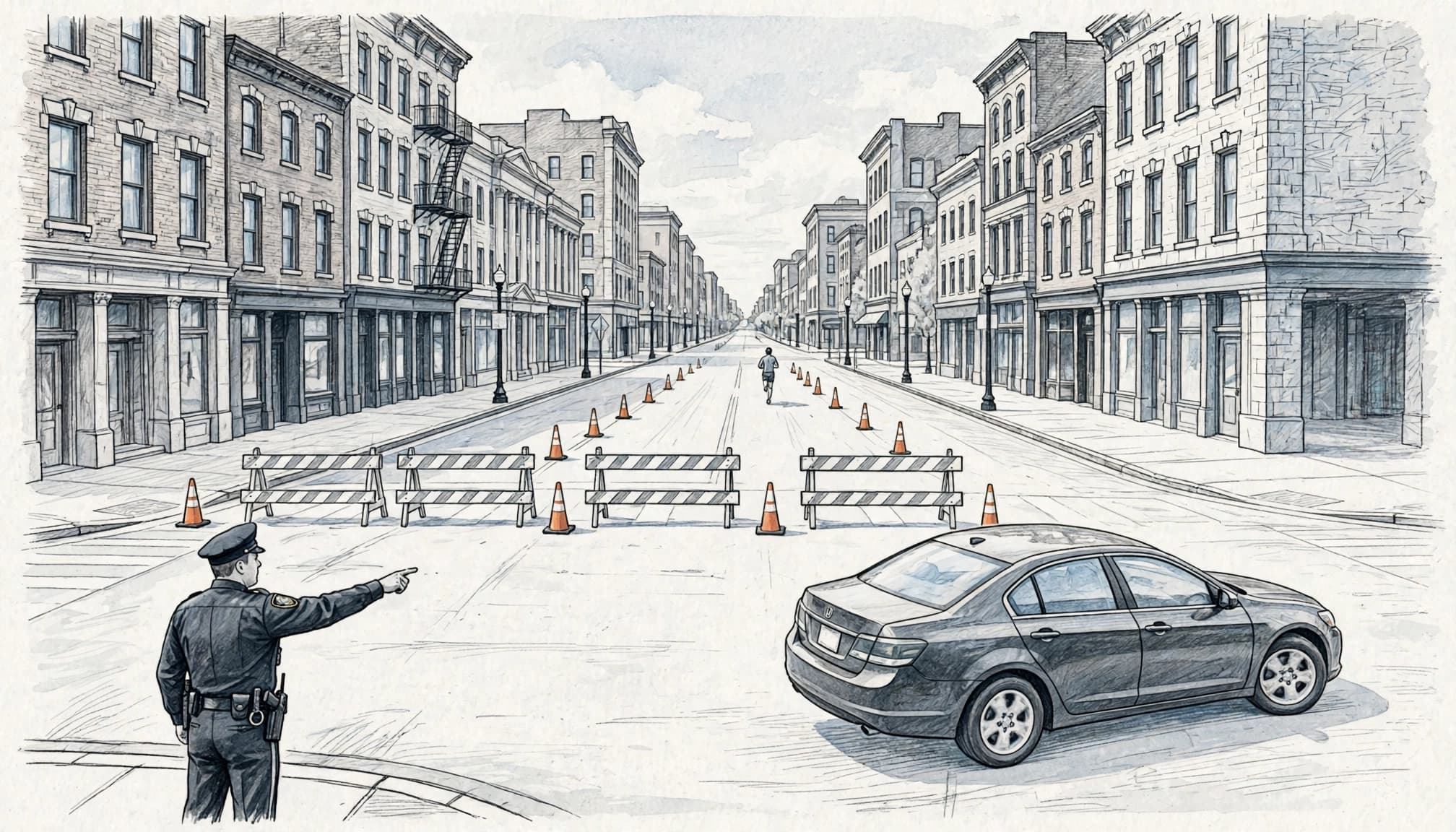
The difference between a rolling closure and a full street closure
A rolling closure moves along with the race. Police officers, course marshals, cones, and temporary barricades hold traffic briefly as runners approach. Once the final runner clears an intersection and staff confirm that it is safe, officers may release vehicles or reopen a cross street.
For example, a driver might wait at an intersection while a group of runners passes. A few minutes later, traffic could move again, even though another section of the course remains closed several blocks away. The delay may still last longer than expected because officers must protect runners, communicate with nearby intersections, and wait for course staff to clear equipment.
A full street closure blocks vehicle access for a scheduled period. Barricades may cover both lanes, while cones separate the race route from sidewalks, aid stations, parked vehicles, or staging areas. Streets near the start and finish often close earlier because large crowds, race equipment, medical teams, and event staff need room before runners arrive.
Police direction takes priority over a navigation app. Never move a barricade, drive around a cone line, or enter a closed course because the street appears empty. A runner, cyclist, emergency vehicle, or race worker may approach from outside your view. Follow the officer’s instructions and use a legal detour instead.
Why the closure times may change from one year to the next
A familiar map can become unreliable when organizers change the course, adjust start times, or schedule the marathon, half marathon, and 8K differently. Runner volume also affects timing. A larger field can extend the period when intersections need police control, especially near narrow streets, turns, bridges, and crowded downtown areas.
Weather can change the plan as well. Rain, cold, heat, or poor visibility may slow runners and lengthen the time needed to keep parts of the route protected. Safety staff may also hold traffic longer near aid stations, medical points, sharp turns, or areas where spectators gather.
After the final runner passes, reopening still happens in stages. Crews must remove cones and barricades, clear discarded cups, inspect the roadway, and release intersections in a safe order. Separate race-weekend events can add temporary no-parking zones or closures outside the main course.
Use the current race map, traffic advisory, and City of Richmond notices rather than an older schedule saved on your phone. A route that worked last year may lead directly into a closure this year.
Where to Find the Official Richmond Marathon Traffic Updates
Reliable traffic information comes from the people managing the race and the streets around it. Use a research plan instead of relying on an old blog post, a social media comment, or a navigation app that has not received the latest closure details.
Check the official Richmond Marathon website once during race week, then review it again on race morning. Also compare its information with City of Richmond notices, police updates, transit alerts, and posted signs near your route.
How to read the race map before you leave home
Start with the official traffic pattern changes page. Mark the start line, finish area, parking garage, hotel, workplace, school, and every cross street you may need. If you are driving someone to the race, mark the drop-off point too.
Read the course map and the traffic-control map together. The course map shows where runners travel, while the traffic-control map usually gives a better picture of barricades, detours, restricted turns, and access limits. A nearby road can close even when runners never use it. Police may need that street for crowd control, emergency access, staging, or a safe crossing point.
Write down the closure window beside each important location. Then identify one legal route in and another route out. If a bridge, downtown intersection, or narrow residential street appears on your path, assume the trip may take longer than the map suggests.
The official race directions can help with planned access, but they shouldn’t replace current traffic notices. Race-day conditions can change after those directions were published.
How to confirm updates when conditions change
Build your final check around what each source does best:
- The Richmond Marathon website and participant emails are the best places for the current course, closure hours, parking guidance, and race-specific changes.
- City of Richmond transportation or public safety notices can clarify detours, no-parking zones, street restrictions, and reopening plans.
- Richmond Police updates may provide information about active intersections, emergency access, enforcement, and unexpected traffic holds.
- Virginia 511 can reveal crashes, road work, congestion, and incidents that affect your alternate route beyond the race course.
- GRTC service alerts can show bus detours, temporary stop changes, and suspended service near closed streets.
- Posted signs near the route often give the most direct warning about tow-away zones, temporary parking restrictions, and local access limits.
Weather can slow runners and delay the reopening schedule. An accident, emergency vehicle movement, medical response, late race activity, or cleanup crew can also keep a road closed after the published time. Therefore, treat every reopening time as a plan rather than a guarantee.
A navigation app may draw a shorter route, but a police officer or traffic-control worker has the final word at a barricade.
Check the official channels during race week and again before leaving on race morning. Follow signs and staff directions, avoid moving barriers, and leave extra time for a route that changes while you are already on the road.
Choose Your Distance, Duration and Goal Time
Make three quick selections and open the exact plan built for your race target.
Looking for a Fully Personalized Training Plan?
The training plans above are an excellent choice if they match your goal. However, if you’d rather train with a plan built specifically around your current fitness, goal race, preferred training days, weekly mileage, and target finish time, our RDA Custom Training Plans provide a personalized solution. We also have running courses available for runners seeking to run faster from the mile to the marathon.
Why Choose a Custom Training Plan?
| Standard Training Plan | RDA Custom Training Plan |
|---|---|
| Follows a fixed schedule | Built around your schedule |
| Standard weekly mileage | Peak mileage customized for you |
| Fixed workout days | Train on the days you choose |
| Same structure for everyone | Designed around your current fitness |
| Static plan | Updated as your fitness improves |
| One-time purchase | Ongoing personalized coaching and support |
What You’ll Receive
- A training plan built specifically for your goal
- Personalized training paces
- Long runs, tempo runs, threshold workouts, interval sessions, recovery runs, and easy runs
- Peak weekly mileage matched to your experience level
- Flexible training schedule that fits your life
- Ongoing plan adjustments as your fitness improves
Ready to Train Smarter?
Stop guessing and start following a plan built specifically for you, your schedule, and your racing goals.
Which Richmond Areas May See the Biggest Traffic Impact?
The biggest delays usually develop where race operations overlap with everyday travel. Downtown streets near the start and finish may close early, while neighborhoods, bridges, major corridors, and spectator areas experience changing access as runners move through.
The exact footprint depends on the current course and race schedule. Before leaving, compare your route with the official traffic pattern changes and treat nearby streets as part of the affected area, even when the race route does not use them directly.
Downtown access near the start and finish areas
Downtown typically sees some of the earliest congestion because crews need space for staging, barricades, medical support, runners, and spectators. Parking restrictions may begin before the starting gun, and delivery access can be limited while race equipment and crowds fill the streets.
A nearby garage may still be open, but that doesn’t guarantee a simple exit. Your vehicle could reach the garage from one direction and later face a closed intersection on the way out. The same route that worked during arrival may be blocked when you return.
Arrive early if you must drive into downtown. Better yet, consider parking outside the most restricted zone and walking the remaining distance. Transit can also make sense when service remains available, especially if you can avoid the final blocks by walking. Check the official marathon parking information before choosing a garage or lot.
Neighborhood streets along the marathon course
Residential areas along the current course may experience short traffic holds or longer closures as runners pass. A street that normally carries local traffic can become a controlled crossing point, particularly near turns, aid stations, spectator gathering areas, or narrow sections of the route.
Residents may face blocked driveways, slower trips, temporary noise, and changes to trash collection. Race staff or city crews may also restrict curb parking before the race, so moving your car before posted no-parking hours begin can prevent towing or an inconvenient lock-in.
If you need driveway access during the event, contact the race organizers or the relevant city department before race morning. Ask when vehicles can enter or leave, rather than assuming a marshal can release the street on request. Visitors should also avoid using residential roads as informal shortcuts because barricades and pedestrian traffic can make them slower than a larger detour.
Landmarks such as Monument Avenue may appear on the current map, but don’t assume every nearby block closes each year. Check the year’s route, then plan access from both directions. A road several blocks away may remain open and provide a much better approach than an intersection beside the course.
Bridges, major crossings, and the best places to cross on foot
Bridges and major corridors can create wide traffic backups because they funnel vehicles into fewer available routes. A closure on one side may also affect streets leading toward the crossing, even when those approach roads remain technically open.
Pedestrians should use official crossing points, usually staffed intersections identified by race personnel or police. Crossing may pause when a dense group of runners approaches, and staff may hold people longer near turns or aid stations. Allow extra time, especially if you need to reach the opposite side of the course before a scheduled start or meeting.
Avoid stepping into the route for photos or attempting to cross between barricades. Wait for staff to signal that the crossing is open, then follow their direction. In many cases, walking a few blocks to a controlled intersection is faster and safer than waiting beside the busiest section.
How to Get Around Richmond During Marathon Road Closures
The best way to handle Richmond marathon road closures is to choose your travel method before race morning. Driving around the city can work, but parking once and walking often creates fewer problems than searching for an open street near the course. Transit, rideshare, and biking can also help, provided you check the current race instructions and allow extra time.
A better parking plan for race morning
Curb parking near the course is risky because temporary signs can change the rules for a single day. A space that is legal on Friday may become a tow-away zone before dawn on Saturday. Race staff and city crews may also place barricades around parked vehicles, leaving your car trapped until the course reopens.
Read every temporary sign on the block, including restrictions for race setup, emergency access, loading zones, and street sweeping. Towing rules still apply during an event, and a vehicle parked before the sign appeared may still be removed if the restriction takes effect later.
A legal garage or lot outside the main closure zone is usually safer. Check its operating hours, payment method, daily maximum, overnight restrictions, and exit rules before you commit. Then walk the route from your parking spot to your destination. A ten-minute walk on an open sidewalk is often easier than circling downtown while streets close around you.
Parking once also gives you a reliable backup. If a road closes before you return, your car remains in one known location instead of sitting on a restricted curb. Use the race’s official parking information when comparing garages and lots.
Getting to the race as a runner or spectator
Arrive earlier than you would for an ordinary race or downtown appointment. You may need time for security, bag check, toilets, warm-up, gear adjustments, and the slow movement of large crowds near the start or finish.
Save the course map, parking location, and meeting point on your phone before leaving. Choose a meeting place away from the finish chute, such as a clearly identified block, hotel entrance, or public landmark. Cell service can become unreliable when thousands of people gather in a small area.
GRTC or another available transit option may reduce driving stress, but check race-day alerts and stop changes before boarding. Never assume a shuttle will run every year. Confirm shuttle details in the current race instructions, including pickup locations, operating hours, payment requirements, and the final stop near the event.
Rideshare users should choose a drop-off point outside the restricted area. A driver may be unable to reach the address beside the start line, even if the app accepts it. Biking can work for some travelers, but use permitted routes, avoid the course, and secure your bike where race operations won’t block it.
What to do if you live or work inside the closure area
Plan every vehicle movement before barricades go up. If you need to leave for work, worship services, an airport, a hospital, or an appointment, move your car before the posted restriction begins and build extra time into the trip. A navigation app may lag behind temporary barricades, so follow current signs and police direction instead of blindly following the blue route on your screen.
Tell guests, contractors, delivery drivers, and rideshare drivers about access limits. Keep sidewalks, driveways, fire lanes, and emergency lanes clear. Don’t ask a marshal to let you drive through a closed intersection, and never move a barricade yourself.
For unusual access needs, contact the appropriate city department or race channel before race morning. If you are traveling to a hospital or responding to an emergency, emergency vehicles and responders always have priority. Follow their instructions immediately and use the legal route they provide.
A Simple Race Weekend Checklist for Safer, Smoother Travel
A smooth race weekend starts before you reach the first barricade. Use this timeline to check Richmond marathon road closures, protect your race plans, and leave room for changes.
Common mistakes that cause delays or unsafe situations
The week before the race, review the current closure schedule, course map, parking information, and transit alerts. An old map may show a route that no longer exists, so save the latest details and download offline maps. Choose a primary route and one legal backup, then confirm that your garage, lot, bus stop, or drop-off point remains accessible.
The evening before, charge your phone and pack identification, medication, race credentials, and any needed accessibility equipment. Runners should check gear-bag rules, prepare hydration and nutrition, and lay out visible clothing or reflective gear for dark streets. Spectators should select a legal viewing area rather than standing beside a narrow finish chute. A second viewing point only makes sense if the map shows open crossings and enough time to walk there.
Several race-day mistakes create avoidable danger:
- Trusting a saved closure map can send you toward a street that changed this year. Check the official race and city updates again before leaving.
- Following a GPS shortcut into a barricade can put you near runners or emergency operations. Stop, obey staff, and use your planned detour.
- Parking on a restricted street can lead to towing or leave your vehicle trapped. Read every temporary sign and use a legal garage or lot instead.
- Waiting beside a narrow finish area can block runners, medical staff, and volunteers. Meet family at a wider location away from the chute.
- Crossing between runners can cause a collision. Use a staffed crossing and wait for permission, even when the course looks clear.
- Assuming a road will reopen at an exact minute can leave you late. Treat posted times as estimates and add extra time for cleanup, equipment removal, and safety checks.
When to call for help or choose a different plan
On race morning, contact race staff for questions about runner access, gear check, course crossings, finish-area meetings, or event-specific detours. Contact the city or the transit agency for public street restrictions, bus changes, parking enforcement, or service disruptions. Race staff cannot always resolve a city parking or transit issue, so use the agency responsible for that problem.
Follow police and traffic-control instructions, even when they differ from your app. Call 911 only for a true emergency, such as a serious injury, immediate danger, or a medical crisis. Don’t use emergency services to ask about parking, race times, or a delayed road reopening.
For the trip home, keep your phone charged, confirm your walking route, and expect the finish area to remain crowded after the last runner arrives. If an appointment, flight, mobility need, medication schedule, or accessibility requirement makes uncertainty costly, leave much earlier or choose a location outside the closure zone. A simple backup plan is far safer than trying to force your way through a changing intersection.
Frequently Asked Questions
Richmond marathon road closures can affect drivers, residents, runners, and transit riders in different ways. Because the course and traffic plan may change each year, confirm race-week details through the official Richmond Marathon website before making final travel plans.
What time do Richmond marathon road closures start?
There isn’t one citywide start time for Richmond marathon road closures. Restrictions vary by street, course segment, race event, and race year, while start and finish areas often require earlier preparation.
Check the current official traffic advisory for each road on your route. Also watch for no-parking restrictions that begin before moving traffic closures, since your vehicle could be towed or blocked in before runners arrive.
When will Richmond marathon streets reopen?
Roads usually reopen in phases after runners, safety vehicles, course staff, and cleanup crews clear each area. One intersection may open while another section remains closed because crews still need to remove cones, collect equipment, or check the roadway.
Avoid planning around an exact reopening minute unless the official notice provides one. Weather, runner pace, medical responses, crowd conditions, and cleanup can all extend a closure.
Can I drive across the Richmond Marathon course?
Crossing depends on police control, runner density, and the specific intersection. Officers may allow vehicles through a staffed crossing during a gap, but they can also hold traffic when runners are approaching or visibility is limited.
Use a staffed crossing or follow an official detour. Never move a barricade, drive around cones, or enter a closed section because the road appears empty. Traffic-control staff may be protecting runners or emergency vehicles outside your view.
Where should I park for the Richmond Marathon?
Start with the current official parking information, then choose a legal garage or lot outside the most restricted zone when possible. Check the facility’s hours, payment rules, walking route, and exit options before race morning.
The best location depends on your destination, arrival time, walking ability, and planned route home. A garage close to the finish may save steps, but a lot farther away could offer a much easier exit after the crowds spread across downtown.
Does GRTC change service during the marathon?
GRTC may adjust routes, stops, schedules, or service patterns during large events. A bus stop that works on a normal weekday may move, close temporarily, or become difficult to reach while the course is active.
Check current GRTC alerts before leaving and allow extra travel time. Keep a walking backup in mind, especially if your stop sits near the start, finish, or a major course crossing.
What should residents do if a closed road blocks their driveway?
Move vehicles before the posted restriction begins, especially if you need to leave during the race. Keep driveways, sidewalks, fire lanes, and emergency access points clear, and tell visitors or delivery drivers about the closure in advance.
For planned access questions, contact official race or city channels before race morning. Staff instructions and safety rules take priority at the barricade, so residents should never move barriers or pressure workers to release a closed street.
Conclusion
A little planning turns Richmond marathon road closures from a race-morning obstacle into a manageable part of the day. Check the latest official notices, study the course and detour map, and choose parking or transit with both arrival and departure in mind. Expect streets to reopen in phases, and follow police officers, traffic-control workers, and race staff when conditions change.
The marathon brings energy to Richmond, but runners, residents, workers, and visitors all need patience while they share the city’s streets. A clear route and realistic time buffer help everyone reach their destination safely. Verify the year’s closure details shortly before race weekend, since schedules, detours, and access rules can change.


