

Richmond Marathon Race Map: Landmarks and Race Tips
Runners, spectators, and visitors search for the Richmond Marathon race map because knowing the route makes race day easier to plan. Runners can study the course before the starting gun, while spectators can choose viewing spots, estimate timing, and plan around downtown traffic and crossing points.
This guide breaks down the course layout, major Richmond landmarks, hills, turns, aid stations, road closures, and spectator access. It also covers practical race-day planning, including where route details matter most and how course features may affect pacing, travel, and support.
The official route can change from year to year, so compare this guide with the current Richmond Marathon website, runner guide, and interactive map before making final plans. Start with the full course layout, then use the landmark and elevation details to understand what you’ll encounter along the way.
Be sure to reserve your Richmond Marathon hotels early to save on higher prices later on.
Build Your Running Performance System
Move from research to action with training, recovery, nutrition, pacing, and performance tools built for runners.
More Guides for This Runner Goal
Key Takeaways
- Use the current official Richmond Marathon course map to confirm streets, turns, aid stations, and any route updates.
- The race begins near Broad Street and finishes downhill at Brown’s Island, creating different pacing demands at the start and finish.
- Plan for city landmarks, river views, historic neighborhoods, parks, and changing road conditions along the course.
- Study hills before race day, then adjust your pace instead of chasing your average split on every mile.
- Spectators should choose viewing points near accessible crossings and allow extra time for closures, parking, and runner travel.
Richmond Marathon Race Map: What the Course Shows
The Richmond Marathon race map is more than a line showing where runners go. It helps you connect the start, finish, landmarks, aid stations, road closures, and spectator access before race morning. Use the map with the current runner guide, because streets, support locations, and access routes can change each year.
Start and Finish Areas to Find First
Begin by locating the start line and finish line on the official map. Then identify the corrals, bag drop or gear check, runner entrances, and post-race area. These locations may sit on different blocks, so don’t assume the finish area is close to the starting corral.
Downtown reference points can help you orient yourself, but always confirm the exact street intersections and access routes in the current map. A route graphic may show the general area while the runner guide provides details about pedestrian entrances, closed streets, and restricted vehicle access.
The start and finish layout affects your entire morning. A hotel that looks close on a map may require a longer walk because of barricades. Parking garages may also have limited access once streets close. Plan extra time for your warm-up, bathroom stop, gear check, and corral entry.
After the race, choose a meeting point outside the busiest finish lanes. Spectators may not be able to reach the finish immediately, and runners often need time to collect gear, receive post-race supplies, or walk through the recovery area.
How the Richmond Course Moves Through the City
Follow the route in segments rather than trying to memorize every turn. Depending on the current race year, the course may connect downtown Richmond with areas near Monument Avenue, the Fan, VCU, the James River corridor, and nearby historic neighborhoods.
These landmarks give you a useful mental outline, but they aren’t a substitute for the official street-by-street route. If the event offers full marathon, half marathon, and 8K maps, open the correct distance before studying turns or planning spectator stops. Shared roads can make different race routes look similar at first glance.
An interactive map helps you zoom into dense downtown blocks, confirm direction changes, and see where the route crosses itself or uses nearby parallel streets. Follow the line between mile markers and check each major turn. That simple habit reduces confusion when several roads converge near downtown or the river.
Map Symbols, Mile Markers, and Detour Notes
Zoom in before race day and study the legend. Look for symbols showing water, sports drink, medical support, toilets, spectator zones, relay areas, course crossings, and the start and finish lines. Mile markers also help you match the map with your training plan, fueling schedule, and planned pace changes.
Read every detour, construction, and access note. A temporary crossing may affect spectators, while a closure can change how you reach a hotel, parking garage, or meeting point. Save these details offline before leaving home:
- Screenshot the correct full, half, or 8K map.
- Save the start and finish locations.
- Record aid stations, medical points, toilets, and gear-check areas.
- Note course time limits and restricted crossings.
- Save your planned parking, hotel walking route, and meeting point.
The current official map and runner guide should remain your source of truth on race weekend.
The Richmond Marathon Route by Neighborhood and Landmark
The Richmond Marathon route becomes easier to follow when you break it into recognizable areas instead of memorizing every street. Downtown blocks, long avenues, university surroundings, river views, and historic districts each create different pacing and navigation demands. Use these landmarks as visual checkpoints, then confirm every street, intersection, and race-distance split on the current official map.
Downtown Richmond and the Early Miles
The opening miles can feel crowded before the field spreads out. Runners move through packed corrals, narrow turns, and city streets where spectators and nearby runners limit visibility. Even experienced runners may lose space when the course changes direction or briefly narrows.
Resist the urge to chase clear road ahead. The starting excitement can push your pace faster than planned, especially when you feel fresh and the crowd is loud. Stay near your assigned pace group, follow the runner directly ahead, and avoid weaving around small clusters unless you need to reach an aid station or respond to an obstruction.
Major downtown avenues, public buildings, and the riverfront can help you understand your position. However, use them as general reference points rather than exact navigation cues. Buildings may look different from street level, and the current route may use nearby blocks or intersections. Check the official Richmond Marathon race map for the exact sequence.
Monument Avenue, the Fan, and VCU Landmarks
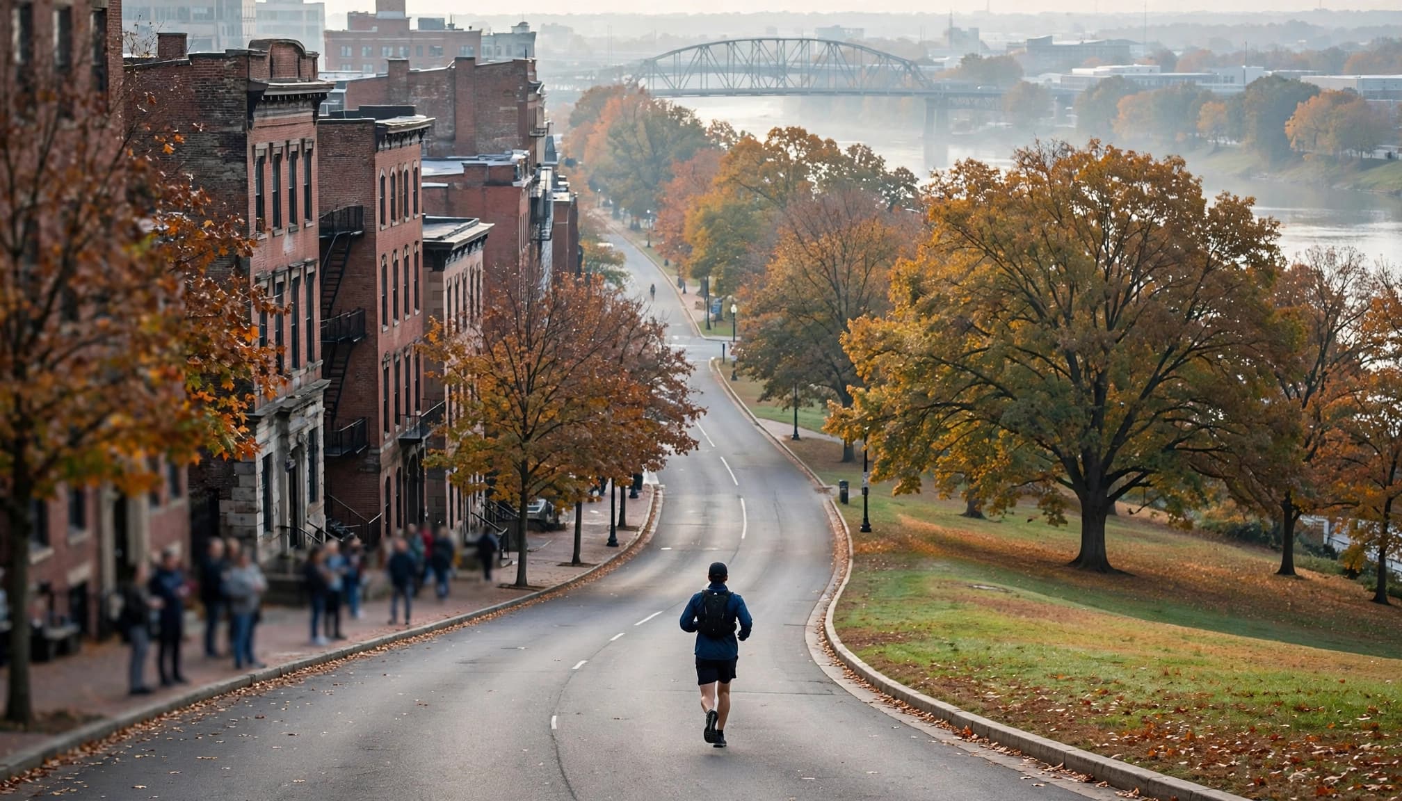
Long avenues and familiar neighborhood streets around Monument Avenue, the Fan, and VCU can make the middle portions easier to recognize. Broad views may help you spot the next turn, while tree cover and historic buildings give the route a clear change from the denser downtown start.
Road width can change quickly, though. A wide avenue may allow a steady rhythm, then a turn into a narrower residential street can compress the pack. Crowds may also block sightlines near intersections, so look for course volunteers, cones, and the runners ahead rather than relying only on distant landmarks.
These areas can also help spectators choose a viewing point, but access depends on closures and crossing rules. Neighborhood access, street names, and intersections may change by race year. Confirm the current map before planning a stop, especially if you want to see both marathon runners and participants in shorter races. Shared sections may separate later, so don’t assume every nearby landmark appears on every distance.
James River Views, Bridges, and Historic Districts
The James River corridor can bring wider views and a noticeable change in surroundings. Depending on the year’s route, runners may encounter a bridge, river-facing roads, changing elevation, or surfaces that require more attention. A scenic section still demands focus, particularly when the road bends or the pack spreads across the available space.
Watch for uneven pavement, expansion joints, patched asphalt, and slick areas near bridges. Short climbs can also feel harder after several miles, so keep your effort controlled instead of forcing your usual flat-course pace. Save your strongest response for the road ahead, not for the view beside you.
Historic areas such as Shockoe or Hollywood Cemetery belong on your plan only when they appear on the official route for that year and race distance. The marathon, half marathon, and 8K may share roads near downtown without visiting the same landmarks. Check the current course map before treating any historic district, bridge, or river overlook as part of your race.
Hills, Elevation, and Pacing Lessons from the Course Map
The Richmond Marathon course map can look mostly flat at a glance, but that view misses short climbs, bridge approaches, ramps, repeated turns, and gradual rises that add effort over 26.2 miles. Read the route map beside an elevation profile so you can plan for changes in effort, not just changes in scenery.
Where the Course May Feel Hardest
Look for several types of difficulty on the official map. Early bridges can interrupt your rhythm before your legs settle, while exposed roads may add wind or direct sun. Rolling neighborhood streets often feel manageable one at a time, yet their repeated rises can become noticeable after several miles.
Late-race turns deserve attention too. Frequent direction changes can disrupt your stride, especially when you are tired or trying to hold a straight-line pace. Check whether the route includes a climb after the halfway point, then note its approximate mile range rather than memorizing one exact street.
The map and elevation profile answer different questions. The map shows where the road bends, narrows, crosses water, or opens into an exposed stretch. The profile shows whether the road rises gradually, climbs briefly, or continues rolling over a longer section.
A route can have modest total elevation but still feel demanding when its climbs arrive after fatigue has already built.
Confirm the details with the official Richmond Marathon course information. If no official profile is available, compare a trusted GPS file with a route-planning tool. Treat small elevation spikes cautiously, since GPS data can exaggerate short changes near bridges, tall buildings, or tree cover.
A Simple Pacing Plan for the Richmond Marathon
Start with a controlled effort, even if the first miles feel easy. Crowds, downhill sections, and race-day excitement can pull you below your planned pace before the course becomes more demanding. Allow the field to spread, then settle into a relaxed rhythm.
Through the middle miles, aim for steady effort rather than identical splits. Short climbs may slow your pace while downhills restore some speed. Use broad landmarks or mile ranges to review your plan, but don’t depend on one exact turn that could change with a future course update.
For the final 10K, make measured decisions. If your breathing, legs, and fueling feel stable, gradually increase your effort on runnable sections. If fatigue is high, protect your form and keep the effort even instead of forcing a pace that the hills or turns no longer support.
Heart rate can provide useful feedback, especially when a climb or crowd disrupts your split. Weather matters as well. Wind, heat, cold, and congestion can all make a rigid pace unrealistic. Your goal is to race the conditions shown on race day, not the conditions you predicted months earlier.
How Weather Can Change the Same Route
Richmond’s November weather can vary, so check the forecast close to race day rather than planning around an expected temperature. A cold start may require a disposable outer layer or gloves, while direct sun later can make exposed roads feel warmer than the air temperature suggests.
Wind near open roads or the river can increase effort without changing the elevation profile. Wet pavement may also reduce traction on bridges, painted markings, metal surfaces, and turns. Choose shoes with dependable grip, and avoid sharp accelerations when surfaces are slick.
Use the map to identify exposed stretches, sheltered neighborhood sections, and aid stations. Then adjust clothing, hydration, and pace according to the actual forecast. The official course information page is the best place to confirm current route details before race weekend.
Aid Stations, Toilets, and Race-Day Logistics on the Map
The Richmond Marathon race map should guide more than your pacing plan. Use it to organize hydration, fueling, bathroom stops, gear check, medical support, transportation, and course cutoffs before race morning. Station locations, product choices, and spacing can change, so confirm the current runner guide instead of relying on an old map or another runner’s race recap.
Planning Water and Fuel Between Aid Stations
Estimate the distance between aid stations by comparing their mile markers on the current course map. Then match that spacing to your expected pace and decide whether you need to carry fluids or fuel between stops. A backup gel or small drink can help if a station is crowded, supplies run low, or you need fuel before the next marked point.
Check which stations offer water, sports drink, gels, or other supplies. The Richmond Marathon FAQ includes race-day details, but the current runner guide and map should control your final plan. Station offerings may differ by location or change between race years.
Practice the same fueling approach during long training runs. Test the timing, amount, packaging, and drink combination before race day. Never try an unfamiliar gel, sports drink, or supplement for the first time during the marathon. Your stomach needs practice just as much as your legs do.
Parking, Transit, Gear Check, and Road Closures
Use the map and official traffic advisory to choose your hotel walking route, transit option, parking area, drop-off point, and gear-check plan. The marathon starts near Broad and 1st Street and finishes near 5th and Tredegar Street, so your post-race route may not match your morning route. The official marathon course information can help you confirm the current start and finish locations.
Arrive early because downtown streets may close before the start. Don’t assume your normal driving route will work on race morning, even if the roads are usually open. Barricades can block garage entrances, hotel approaches, and cross streets well before runners reach those areas.
Check the event’s transportation and road-closure updates shortly before the race. Pack your gear bag the night before, confirm where gear check opens, and save the meeting point offline. A simple plan should answer three questions: where you leave your belongings, how you reach the start, and how you reunite after finishing.
What to Do if You Need Medical Help or Must Stop
Before starting, locate medical stations, course marshals, official vehicles, and aid points on the current map. Also identify the nearest staffed point along your planned route, especially if you have a health concern or expect to run in changing weather.
If you feel faint, confused, unusually short of breath, injured, or unable to continue, slow down and tell a volunteer. Follow staff directions rather than leaving the course alone or choosing an unfamiliar shortcut. Volunteers can contact the race medical team and help direct you safely.
Carry emergency contact information with your required identification, and know how to reach the race medical team through the instructions provided by the event. Don’t rely on an old phone number or assume a particular evacuation route will be available. Course access can change with traffic controls, so let race staff coordinate the response.
Best Places to Watch the Richmond Marathon
The best Richmond Marathon viewing spot depends on the runner’s pace, the course direction, transit access, and your priorities. Someone who wants to see the start needs a different plan from a spectator hoping to catch a runner late in the race.
Use the official spectator information and current race map before choosing a location. Course access, closures, and recommended viewing areas can change each year.
How to Choose More Than One Spectator Spot
Seeing a runner twice can work, but only when the travel time is realistic. Choose one early location and one later location near a major landmark or transit corridor shown on the Richmond Marathon race map. Avoid planning stops on opposite sides of the course unless the official guidance confirms an open crossing or direct transit connection.
Estimate the runner’s arrival time before you choose your first spot. Divide the distance from the start by the runner’s expected pace, then add time for the start-line delay and crowd movement. For example, a runner averaging 10 minutes per mile may reach mile 5 about 50 minutes after their actual start, but spectators should allow extra time for corrals, packed sidewalks, blocked roads, and difficulty finding the right corner.
Use this simple planning method:
- Note the runner’s expected start time and target pace.
- Estimate arrival at each possible mile marker.
- Add at least 15 to 30 minutes for spectator travel and congestion.
- Check whether roads, sidewalks, and transit routes remain open.
- Choose the second location only if the schedule still leaves a comfortable margin.
A short distance on the map can take much longer on race day. Barricades may force you several blocks away, while large crowds can slow a walk that normally takes five minutes.
Meeting Runners Near the Finish Line
The finish area is usually one of the most crowded parts of the course. Runners leave through controlled recovery zones, spectators gather near barriers, and volunteers may restrict access to certain streets. A restaurant, storefront, or named corner near Brown’s Island may sound convenient, but it may be unreachable when you arrive.
Agree on a backup meeting place outside the busiest finish zone. Pick a location that has room to stand, a clear street address, and a route runners can reach after collecting post-race supplies. Keep your phone fully charged, and make sure everyone knows what to do if cell service becomes slow or the group gets separated.
Check whether spectators can enter the post-race area before race morning. Follow barricades, volunteers, police officers, and the event’s official access rules. The current course information should guide your plan if the finish layout or pedestrian routes change.
Accessibility and Family-Friendly Viewing Plans
Families, older spectators, and people with mobility needs should inspect more than the route line. Check for paved sidewalks, stairs, restroom access, seating, crowd density, transit connections, and approved crossing points. The event parking and transit information can help you compare driving with public transportation.
Never cross the course outside an approved crossing, even when your runner is approaching. Volunteers may hold pedestrians until a safe gap appears, and closed streets can make a nearby landmark inaccessible.
Keep children in bright, visible clothing and set a meeting plan before leaving home. Choose one primary location and one backup point away from the finish crowd. Share the runner’s bib number, expected timing, and phone number with every adult in the group, then stay behind barricades throughout the race.
How to Prepare with the Map Before Race Weekend
A map becomes useful when it guides decisions, not when you memorize every street. Spend one short session studying the route, then turn what you see into pacing, fueling, clothing, and travel choices. This preparation works whether you live nearby or are staying in downtown Richmond.
Mark Your Personal Course Plan
Use a printed Richmond Marathon race map or a saved digital copy. Mark the start, halfway point, key hills, aid stations, toilets, fuel reminders, and the final 10K. Keep your notes simple, with cues such as relax, drink, fuel, and hold pace. A crowded map can become harder to read when you are tired.
Add a small note beside any bridge, exposed road, narrow turn, or late climb. These reminders help you recognize where to adjust effort without checking your watch every few minutes. Save the map offline or take screenshots of the relevant sections because cell service may slow down near crowded downtown areas.
The official Richmond Marathon course map should be your starting point. Save the current version rather than an image from an older race year.
Practice the Hard Parts Before Race Day
You don’t need to copy every street to prepare well. Instead, match the course’s demands with nearby options. Local runners can use hills, bridges, rolling roads, and long straight sections. Visitors can use a treadmill incline session or a short route near their hotel.
Practice the effort shown by the elevation profile. Run controlled uphill sections, settle your breathing at the top, and avoid sprinting the downhill. Include crowded or narrow conditions in training by running on a busy shared path, taking turns around other runners, or practicing how you reach an aid station without weaving.
Your long runs should also test:
- Fuel timing and the exact products you plan to use.
- Clothing layers for the forecast, including gloves or a disposable outer layer.
- Bathroom timing before and during longer efforts.
- Bottle handling and drinking while maintaining an easy rhythm.
A Final Richmond Marathon Map Checklist
Before leaving for the start, compare your plan with the official race guide. Confirm:
- The latest official route version, race date, start time, and distance.
- Start and finish locations, corral assignment, aid stations, and toilets.
- Gear-check procedures, parking or transit, and road closures.
- Weather, course time limits, and emergency contact details.
The latest runner guide takes priority over screenshots, blog posts, and older GPS routes. Check it again on race weekend, then keep the final map available offline.
Frequently Asked Questions
The Richmond Marathon race map is useful only when you pair it with current race instructions. Routes, access points, and event services can change, so check official information before race morning.
Where can I find the official Richmond Marathon race map?
The current map is usually posted on the official course information page or included in the event’s runner information and participant guide. Look for an interactive map or a downloadable file, rather than relying on an image shared in an old race recap or social media post.
Check the race year and distance before studying the route. The marathon, half marathon, and 8K may share streets but follow different turns and support points.
Does the Richmond Marathon course change from year to year?
Yes, the route can change because of construction, permits, safety requirements, transportation plans, or event operations. Familiar landmarks may remain, but the event can move turns, aid stations, start areas, crossing points, or road closures.
Review the newest map and official race guide before making travel or pacing plans. A previous year’s course is helpful background, but it shouldn’t control your race-day decisions.
Is the Richmond Marathon course flat?
The course may include long, runnable sections, but a simple “flat” label doesn’t tell the whole story. Bridges, short climbs, rolling streets, frequent turns, and late-race fatigue can all affect how the route feels.
Use the current elevation profile alongside the map. Focus on steady effort over climbs, then regain rhythm gradually instead of forcing your target pace on every uphill section.
Can spectators cross the Richmond Marathon course?
Spectators should cross only where police officers, volunteers, and event barricades allow it. A nearby intersection may look open but still be closed for runner safety or traffic control.
Follow the official spectator guidance and leave extra time between viewing locations. Never step in front of runners, move through a closed road, or push past a barricade to reach someone.
What should I bring when using the race map on race morning?
Bring a fully charged phone with the map saved offline, plus a small printed backup. Keep the runner guide, identification, permitted personal medication, and any approved fueling items with your race gear.
Phones can lose service or battery power in crowded areas. Write down key directions, parking details, your meeting point, and important contact information before leaving for the start.
Where do the Richmond Marathon start and finish?
The exact locations depend on the current event setup, so confirm them on the latest map and runner guide. Check the street intersections, corral entrances, gear-check location, post-race area, and spectator meeting rules.
Don’t rely on a previous year’s start or finish location. Even a small change can affect your walking route, parking plan, hotel access, and where you reunite after the race.
Conclusion
The Richmond Marathon race map is more than a picture of the route. It helps runners plan pacing, fuel timing, transportation, landmarks, and key course sections before race morning. It also helps spectators choose safe viewing spots, estimate runner arrival times, and avoid blocked roads or restricted crossings.
Use the map with the current runner guide and official race updates. Review the start and finish areas, aid stations, hills, road closures, and spectator access before you leave home. Then adjust your plan for weather, crowds, and any course changes announced during race week.
Download the latest official Richmond Marathon map, save it offline, and keep your plan flexible. A few minutes of preparation can make the course easier to follow and race day less stressful.


