

Montreal Marathon Map: Course Route, Aid Stations & Elevation
Studying a Montreal marathon map before race morning can sharpen your pacing and reduce avoidable stress. The course map is more than a line connecting the start and finish, because it shows where turns, hills, landmarks, aid stations, transportation points, and spectator areas may shape your race.
When you know what’s ahead, you can plan where to settle into rhythm, where to protect your effort, and where friends or family can see you. Beginners gain confidence from understanding the route, while experienced marathoners can use the map to refine pacing choices, fueling timing, and race-day logistics.
Keep in mind that the official Montreal Marathon course can change from year to year. Confirm the latest map, race guide, and runner instructions through the event organizer before traveling, then compare the route with your hotel, transit plans, and meeting points.
With that preparation in place, you can focus less on finding your way and more on executing your race plan. Next, I will examine the course layout and the key details to study before the starting gun. Be sure to book your Montreal Marathon hotels early and in advance to save money.
Key Takeaways
- Study the latest Montreal marathon map to understand turns, hills, landmarks, aid stations, and the finish area before race morning.
- Use station locations to plan water, electrolytes, gels, and pacing instead of relying on last-minute decisions.
- Check the official Montreal runner’s guide for course updates, station details, race rules, and participant instructions.
- Match your hotel, transit route, bag drop, meeting points, and start-line arrival time to the course layout.
- Expect possible route changes, then verify every detail with the organizer before traveling.
The Montreal Marathon Map: What the Course Layout Tells You
An official Montreal marathon map gives you more than distance and direction. It shows how the race fits into the city, where logistics may slow you down, and which sections deserve attention before race morning. Use the current race map, not an old social media image or an unofficial GPS route.
If available, download the map as a PDF, interactive page, GPX file, or other course file. Then compare it with a street map so you recognize major roads, parks, bridges, waterfront sections, and neighborhood changes before you arrive.
Find the Start Line, Finish Area, and Runner Services
Begin by locating the start corrals and finish area. Then identify bib pickup or the expo, bag check, gear drop, portable toilets, warm-up space, medical support, and the post-race recovery zone. The official Montreal runner’s guide should confirm the latest locations, schedules, and access rules.
The start and finish may sit in different parts of the city because organizers need enough room for corrals, road closures, spectators, and runner recovery. That layout can add more walking than expected. Plan the full movement from your hotel or transit stop to bag check, then to your corral, and later from the finish to transportation or your meeting point.
Allow extra time for security, crowded sidewalks, restroom lines, and a slow walk after the race. If you check a bag, confirm where you retrieve it before leaving the start area. A simple route plan can prevent a tired search through unfamiliar streets.
Mark Aid Stations, Timing Mats, and Key Course Turns
Read the map with your race plan beside you. Mark each water station, sports drink station, gel location, medical station, timing mat, turnaround, and confusing intersection. The official guide may separate stations by race distance, so confirm what the marathon receives rather than assuming every service applies to your event.
Timing mats can show intermediate splits and support athlete tracking. The official half-marathon course information also illustrates why runners should check whether a course shares sections with a half marathon, relay, 10K, or 5K.
Use the map to decide where you will:
- Take water, electrolytes, or course-provided fuel.
- Slow briefly before a crowded station.
- Adjust a layer without blocking other runners.
- Check your watch at a timing point or major turn.
- Look for medical help if pain or heat symptoms develop.
Station services and locations can change, so verify every detail in the current race guide.
Use Landmarks to Memorize the Route
Memorize the course in sections instead of trying to recall every street name. A waterfront stretch, park entrance, bridge crossing, major avenue, neighborhood transition, or final approach creates a stronger mental marker than an isolated kilometer sign.
For example, divide the route into early city streets, a confirmed park or waterfront section, the middle turnaround, the return toward downtown, and the finish approach. Check each landmark against the official map, because familiar names can appear in different parts of Montreal.
Before race day, confirm this short list:
- Start corrals, finish area, and transport route.
- Distance markers, turnarounds, and shared race sections.
- Timing mats, aid stations, toilets, and medical points.
- Bag check, gear drop, warm-up, and recovery locations.
- The current map version and any road or course updates.
That preparation turns the Montreal marathon map into a practical race plan rather than a line on a screen.
How the Montreal Marathon Route May Feel From Start to Finish
A Montreal marathon map shows the route, but it cannot predict every sensation on race morning. Weather, wind, crowd density, pavement feel, and congestion can change how the same section feels from one year to the next.
Study the map beside the official elevation profile and current road closure notices. The Montreal marthon visit guide can also help you connect the course with transportation and race-day logistics.
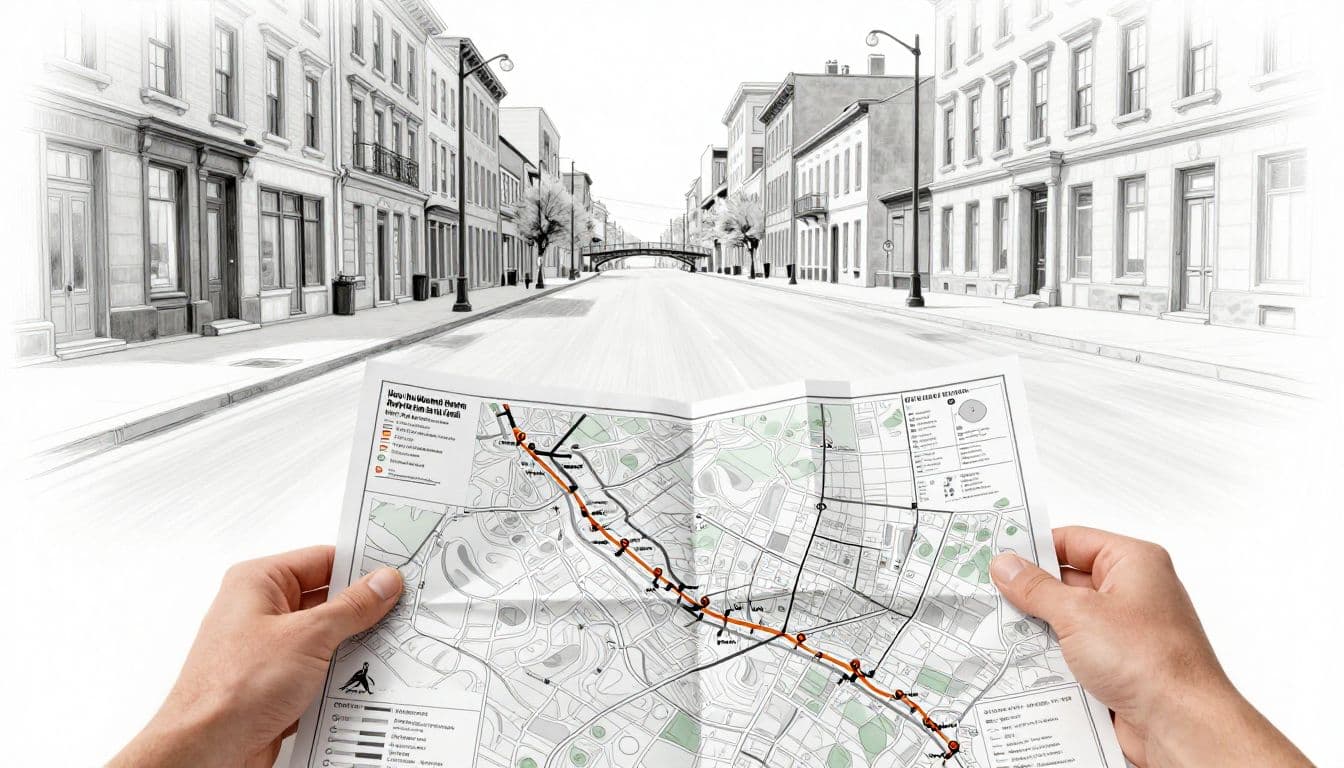
Plan for Early Crowding and a Controlled Start
The opening kilometers may feel slower than your goal pace. Corrals release runners in waves, narrow roads compress the field, and athletes need time to settle into position. Even a wide street can feel tight when thousands of runners move through the same space.
Resist the urge to weave around people. Repeated accelerations waste energy before the marathon has properly started, and the first miles should feel controlled rather than competitive. If your watch shows a slower pace, protect your rhythm and allow the field to spread.
Use the Montreal marathon map to identify the first major turn and the point where the route may open up. That landmark gives you a clear short-term target. Runners who are sensitive to congestion should start near the appropriate pace group and leave extra room around aid stations and sharp turns.
Read the Middle Miles for Pace and Fuel Decisions
The middle of the course is easier to manage when you divide it into blocks. Use landmarks, timing mats, or aid stations to create short sections instead of carrying the full marathon distance in your head.
Tie each block to a practiced action. You might check effort after one landmark, drink at the next station, and take a gel according to your training schedule. Race-provided fluids or fuel can help, but you should know what you tolerate before race day. Carry the products you need if the available options differ from your usual plan.
Use the course map to schedule decisions, not to chase every split.
Check the elevation profile before the race, especially if hills, bridges, or long exposed roads concern you. On an uphill, protect effort and accept a modest pace change. On a downhill, avoid sprinting simply because the watch shows a faster split. Controlled downhill running saves more energy than forcing speed early.
Wind and heat can also change the effort of an apparently flat section. When shade or spectators disappear, rely on breathing, posture, and effort rather than pace alone.
Prepare for the Final Miles and Finish-Line Approach
The last portion often feels longer than its distance suggests. Repeated turns, bridge crossings, exposed roads, and late-race fatigue can make familiar streets feel unfamiliar. Mark the final aid station on your map, then decide where you will begin a controlled push if your legs and effort allow it.
That push should build gradually. Keep your stride relaxed, maintain fueling until you no longer need it, and avoid spending everything on one visible landmark. A finish line that appears nearby may still require several turns or a longer approach.
Study the finish-area layout before race morning. The finish arch may not be close to bag retrieval, medical support, transportation, or your meeting point. Review the organizer’s current instructions, then choose a post-race route that remains simple when walking becomes difficult.
Build a Race-Day Plan Around the Montreal Marathon Course Map
A Montreal marathon map becomes useful when you connect it to decisions you can make before race morning. Add your travel time, road closures, pacing targets, fueling points, weather plan, and spectator meeting spots instead of treating the course as a simple line.
Start with the latest official map and race notices, then build your plan in this order:
- Mark the start, finish, corrals, bag drop, aid stations, toilets, and major turns.
- Add your hotel, transit stop, parking option, and post-race meeting point.
- Create a simple chart with expected pace, effort, fueling, and backup choices.
- Review the plan again shortly before race day, when closures and transit details are current.
Choose Transportation and Arrive With Extra Time
Check the event’s transportation instructions before you leave home. Review metro and bus service, parking restrictions, shuttle routes, bag-drop rules, and corral opening times. Montreal street closures can change normal travel times, so a route that looks quick on a weekday map may become unusable on race morning.
Public transit may be the simplest choice, but confirm the first train or bus times and identify a backup station. If you plan to drive, don’t depend on reaching a nearby garage through streets occupied by the race. Choose a legal parking area outside the closure zone, then allow extra time to walk.
Your backup plan should include another transit route, a second meeting point, and enough time for restroom lines or a missed connection. Runners and spectators also need different routes. The best path to the start may not be the best way for family members to reach the finish or cross the course.
Match Pacing and Fueling to the Route
Turn the Montreal marathon map into a one-page race chart. Divide the course into practical blocks and write down your planned pace, expected effort, fueling point, and backup action for each one. Include hills, exposed roads, sharp turns, crowded sections, and long stretches between services.
Pace targets should guide you, not control you. If heat, wind, hills, or congestion affect the route, use breathing, posture, and perceived effort to protect your race. A slower uphill split can be the correct decision when it keeps your effort steady.
Plan nutrition around training, not race-day experimentation. Practice the same gels, sports drink, water pattern, clothing, and watch alerts you expect to use. Carry a backup gel if a station is crowded or you miss your planned pickup. If cold rain, heat, or strong wind appears in the forecast, adjust clothing and effort before the start.
Help Spectators Find Useful Viewing Spots
Spectators should choose one or two realistic viewing points instead of trying to chase you across Montreal. Look for areas near reliable transit, wide streets, public toilets, food, course crossings, and a clear meeting point after the race.
Distance on the map can be misleading. A location may look close but sit behind fences, blocked roads, or a one-way race corridor. Before selecting a spot, confirm that spectators can reach it, cross the course safely, and leave without entering restricted areas.
Share the plan with your support crew before race morning. Give them your expected arrival window, bib details, clothing description, and a fallback meeting point. If weather or fatigue changes your pace, a fixed location is easier to manage than a moving target.
Compare, Download, and Verify Every Montreal Marathon Route Detail
A Montreal marathon map is most useful when you compare it with the organizer’s other race information. The interactive map may show the full route, while the printable PDF highlights landmarks and aid stations. The race guide, runner emails, elevation profile, closure notices, and any organizer-supplied GPX file each answer different questions.
Start with the newest information from the official Montreal runner’s guide. Save an offline copy, then take screenshots of the start area, finish area, aid stations, and road closure details. That small step protects you if cell service becomes slow or unreliable on race morning.
Use a GPX File or GPS Watch Without Overtrusting It
If the organizer provides a GPX file, load it onto a compatible GPS watch or running app before traveling. Open the route and inspect its total distance, elevation profile, major turns, and start and finish points. Zoom in around bridges, turnarounds, park paths, and sections where several roads sit close together.
Set distance, pace, or heart-rate alerts as reminders rather than commands. GPS drift can create inaccurate splits, especially near tall buildings, tunnels, bridges, and crowded streets. The signal may also cut corners or place you on a parallel road.
A GPX route can guide training and help you understand the course shape, but it may not match the certified race line. Temporary barriers, one-way sections, closed intersections, corral access, and finish-area restrictions won’t always appear in the file. Follow official course arrows, kilometer signs, barriers, and volunteers first.
Your watch measures a signal. Race staff control the route.
Choose Your Distance, Duration and Goal Time
Make three quick selections and open the exact plan built for your race target.
Looking for a Fully Personalized Training Plan?
The training plans above are an excellent choice if they match your goal. However, if you’d rather train with a plan built specifically around your current fitness, goal race, preferred training days, weekly mileage, and target finish time, our RDA Custom Training Plans provide a personalized solution. We also have running courses available for runners seeking to run faster from the mile to the marathon.
Why Choose a Custom Training Plan?
| Standard Training Plan | RDA Custom Training Plan |
|---|---|
| Follows a fixed schedule | Built around your schedule |
| Standard weekly mileage | Peak mileage customized for you |
| Fixed workout days | Train on the days you choose |
| Same structure for everyone | Designed around your current fitness |
| Static plan | Updated as your fitness improves |
| One-time purchase | Ongoing personalized coaching and support |
What You’ll Receive
- A training plan built specifically for your goal
- Personalized training paces
- Long runs, tempo runs, threshold workouts, interval sessions, recovery runs, and easy runs
- Peak weekly mileage matched to your experience level
- Flexible training schedule that fits your life
- Ongoing plan adjustments as your fitness improves
Ready to Train Smarter?
Stop guessing and start following a plan built specifically for you, your schedule, and your racing goals.
Check Course Changes, Closures, and Race-Week Notices
Compare the interactive course map, printable PDF, race guide, elevation profile, organizer emails, and road closure notices during race week. Check again the day before the event. The Marathon Beneva de Montréal event page is a useful place to find current organizer information, but always follow the newest race-specific notice.
Look for changes involving:
- The start and finish areas.
- Corrals, bag check, and runner access.
- Aid stations, turnarounds, and timing points.
- Transit routes, parking, and road closures.
- Weather procedures, delays, or cancellation plans.
If an old blog post, saved screenshot, or crowd-sourced map disagrees with the current organizer announcement, discard the older version. Don’t try to average the two maps. Write the confirmed detail into your race briefing and use that version on race morning.
Make a One-Page Route Briefing
A compact briefing reduces decisions when the start area is loud, crowded, and rushed. Write down the corral arrival time, start location, first major turn, planned fueling points, difficult sections, effort changes, finish location, and post-race meeting point.
Add your backup choices beside the details that could cause stress. Note an alternate transit stop, a missed aid-station plan, and where you’ll retrieve your bag. Keep the page on your phone offline, then carry the essential information in a screenshot or small printed note.
Before leaving your hotel, confirm:
- The map version matches the newest official notice.
- The GPX route agrees with the official turns and distance.
- Your transit route avoids race-day closures.
- Your fueling and pacing plan fits the elevation profile.
- Your meeting point remains accessible after the finish.
With those details checked, the Montreal marathon map becomes a clear set of decisions instead of another screen to study.
Common Montreal Marathon Map Mistakes That Can Cost Time and Energy
A course map only helps when you treat it as current race information, not a rough sketch of Montreal. Small planning errors can create extra walking, missed fueling opportunities, unnecessary surges, and confusion after the finish. Use the latest official Montreal runner’s guide as your final reference, then adjust your race plan to match the conditions you actually face.
Do Not Confuse a Training Route With the Certified Race Course
A popular Montreal running route may follow attractive streets, parks, or waterfront paths without matching the marathon’s certified race line. The same problem appears with maps from past editions and community-created GPS tracks. Organizers can change turns, road access, aid-station locations, start corrals, and finish procedures between races.
Use unofficial routes for training ideas only. They can help you preview terrain or practice sections, but they shouldn’t decide where you expect to turn or refuel. Before race day, compare your saved map and GPX file with the newest organizer instructions.
Check these details again during race week:
- The current start and finish locations.
- Every turnaround, major turn, and shared section.
- Aid stations, medical points, and timing mats.
- Road closures, transit access, and bag pickup.
If two sources disagree, follow the newest official notice. Running an old route can cost time when you hesitate at an intersection, and it can cost energy when your planned fueling point no longer exists.
Do Not Race the Map Instead of Racing by Effort
Your watch may show a perfect target split, but the opening kilometers rarely provide perfect conditions. Crowded corrals, sharp turns, hills, heat, and headwinds can all slow your pace while your effort remains appropriate.
For example, forcing marathon pace uphill because your watch shows a lost few seconds can raise your breathing and drain energy too early. The same mistake occurs when runners weave through a crowded start to recover a slow split. Those short surges may feel harmless, yet they accumulate before the halfway point.
Use pace as a guide, then let effort control the decision. Stay patient during the first half, shorten your stride on climbs, and accept slower splits into strong wind. When the route opens and conditions improve, you can return to goal pace without chasing every previous number.
A GPS watch can report your pace, but it cannot measure the energy you spend fighting the course.
Do Not Leave the Finish Plan Until After the Race
Many runners study the route carefully, then treat the finish area as an afterthought. That mistake can turn a successful marathon into a long, confusing walk. Tired legs make simple directions feel difficult, especially when barriers separate the finish chute from recovery services or transportation.
Before race morning, locate:
- Medal collection and refreshments.
- Medical care and recovery services.
- Bag pickup or gear retrieval.
- Family meeting areas.
- Metro, bus, shuttle, or parking access.
Don’t assume the shortest walking route remains open. Race fencing, road closures, one-way pedestrian flows, and restricted runner zones may force a longer path. Choose a meeting point outside the busiest exit area, and share a backup location with your family.
A clear finish plan also prevents missed meetings. Save the relevant map details offline, tell your support crew when you expect to arrive, and decide where you’ll go if your phone battery runs low. When your legs are tired, fewer decisions mean more energy for getting home safely.
Frequently Asked Questions
A Montreal marathon map helps you prepare, but only when you know which version to trust and how to read it. These answers cover the practical questions runners and spectators often have before race morning.
Where can I find the official Montreal marathon map?
Start with the event’s official website, then open the runner information page for your race edition. The organizer may also include the latest map in the race guide or send it through official race-week emails. The official Montreal runner’s guide is the best place to check current course and race-day details.
Before saving or printing anything, confirm the edition and publication date. A map from last year’s race may show a familiar route but outdated aid stations, start areas, road access, or finish procedures.
Does the Montreal marathon route change each year?
Yes, organizers may adjust the route or race logistics between editions. Permit conditions, construction, safety planning, city operations, road work, and transit needs can affect streets, turns, aid stations, corrals, start locations, and finish areas.
Older maps still help you understand the general shape of the course. However, treat them as historical references rather than race-day instructions. Replace them with the newest organizer map and race-week communications before you travel.
Can I use the Montreal marathon map to plan my pacing?
You can use the map to divide the race into manageable distance blocks and identify hills, sharp turns, aid stations, and sections that may become crowded. Those details help you decide where to settle, conserve energy, take fuel, or check your effort.
Pair the map with the official elevation profile and the weather forecast. Then use a practiced effort-based pacing plan, because wind, heat, hills, and congestion can make exact splits unrealistic. Your watch should guide decisions, while breathing and effort tell you whether the plan remains sustainable.
Is there a downloadable GPX file for the Montreal marathon course?
A downloadable GPX file may be available, but that depends on the organizer and the specific race edition. If provided, you can load it onto a compatible watch or running app to preview turns, elevation, and course distance during training.
Still, a GPX file is a planning aid, not permission to ignore race instructions. GPS can drift near buildings, bridges, or crowded streets, and temporary barriers may not appear in the file. Follow official markings, signs, and course staff on race day.
How should spectators use the marathon course map?
Spectators should choose one or two accessible viewing points near public transportation. Check the race direction, road closures, pedestrian access, and walking time between locations before settling on a plan. A spot that looks close on the map may sit behind barriers or a closed intersection.
Set a designated meeting area after the finish instead of relying on a crowded landmark beside the course. Share the location with your runner beforehand, along with a backup plan if mobile service is slow or the runner’s pace changes.
What should I do if my map conflicts with race-day signs?
Follow the newest race-day signs, course marshals, volunteers, and organizer instructions. Temporary safety changes can affect a turn, barrier, crossing, or access route without appearing on a saved PDF or GPS file.
If you feel uncertain, slow down and ask the nearest official. Never choose a direction based only on an old screenshot, personal GPS route, or memory of a previous Montreal marathon.
Conclusion
A Montreal marathon map is a performance tool, not just a navigation aid. Download the current official map, study the course in sections, and mark the aid stations, fuel points, major turns, and demanding sections. Then match those details with your transportation plan, spectator access, finish-area route, and pacing strategy.
Verify race-week changes through the organizer, especially for road closures, station locations, corrals, and course adjustments. During the race, let effort guide your pace when hills, wind, weather, or crowds affect your splits. With the route familiar before the starting gun, an unfamiliar city course becomes a series of manageable decisions, each one easier to execute when fatigue arrives.


