

Hiking Trails in West Virginia: Wild Gorges & Stunning Summits
West Virginia’s hiking trails lead to rocky overlooks, rushing waterfalls, quiet forests, and long-distance routes through mountain country. The variety makes it easy to find a hike that suits your plans, but trail length, difficulty, weather, and access can change from one area to another.
This guide features standout routes such as Endless Wall, Seneca Rocks, Blackwater Falls, and Dolly Sods, along with advice for choosing a hike that fits your time and experience. You’ll also find practical tips for checking trail conditions and preparing for the state’s changing mountain weather.
Start with the hiking trails that match your interests, then use the planning advice to choose a route that fits the day. Be sure to check out the RunDreamAchieve YouTube channel for weekly running tips.
Key Takeaways
- Hiking trails in West Virginia lead through forested gorges, past waterfalls, and up to mountain overlooks.
- Endless Wall, Seneca Rocks, Blackwater Falls, and Dolly Sods offer distinct scenery and hiking experiences.
- Choose a route based on your available time, experience, trail length, and difficulty.
- Trail access and conditions can change, so check the National Park Service’s New River Gorge trail updates before setting out.
- Mountain weather can shift quickly, so review the forecast and prepare for conditions along your route.
Hiking Trails in West Virginia for Views, Waterfalls, and Wild Highlands
These well-known hikes show how varied West Virginia’s trails can be, from gorge overlooks to high-elevation wetlands. Distances and effort depend on the route you choose and current trail conditions, so confirm details with the park or forest before you go.
Take in New River Gorge from Endless Wall and Long Point
Endless Wall Trail winds through forest, crosses Fern Creek, then follows the sandstone cliffs above New River Gorge. The walk is about 2.2 to 2.6 miles, depending on the route. Long Point offers a different experience: a more open approach to a broad view of the gorge and New River Gorge Bridge. Plan on roughly 3 miles round trip, and check the National Park Service’s trail details for current route information.
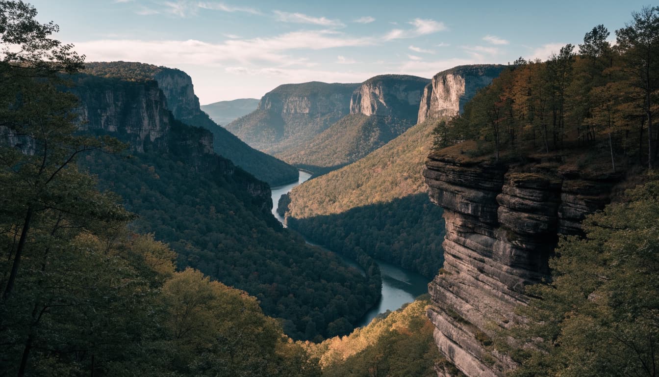
Both hikes are manageable for many visitors, but the cliffside sections demand care. Edges can be exposed, and rocks may be uneven or slick. Keep your footing, stay behind barriers, and avoid approaching the edge for a photo. Check parking and access before driving to the trailhead.
Climb to the Seneca Rocks overlook
The marked trail at Seneca Rocks climbs steeply through rocky forest to an observation platform with a striking view of the fins and surrounding mountains. Expect a sustained uphill hike with close to 1,000 feet of elevation gain, so allow time for breaks and bring sturdy shoes with good traction.
The climb feels strenuous, especially on the return, when tired legs meet the descent. Follow the signed hiking route to the platform rather than entering technical climbing routes on the rocks. Those routes require climbing skills and equipment, and they are separate from the established foot trail.
Find waterfalls and forest paths at Blackwater Falls
At Blackwater Falls State Park, a short walk and stairway lead to viewing areas overlooking the falls, where the water drops into a dark, forested gorge. Nearby trails offer longer walks through the park, while Blackwater Canyon Trail suits hikers looking for a more extended outing along the canyon.
Stairs and damp surfaces can make even a short visit slippery. In winter, ice may affect access and footing; after storms, trail conditions can change as well. Check which routes are open before setting out, and choose a hike that fits the day’s weather and your experience.
Experience the open highlands of Dolly Sods and Cranberry Glades
Dolly Sods feels exposed and windswept, with open high-country terrain, rocky paths, and boggy stretches that contrast with the state’s forested valleys. Weather can shift quickly at this elevation, and trails may turn muddy or become hard to follow. Carry a map, check the forecast, and stay on marked paths around bogs and fragile plants.
Cranberry Glades offers a gentler way to experience a sensitive wetland habitat. Boardwalks cross the glades, letting visitors observe the unusual plant communities without walking through the bog. Stay on the designated paths here, too, and check local updates before visiting, since access and trail conditions can change.
Choose Your Distance, Duration and Goal Time
Make three quick selections and open the exact plan built for your race target.
Looking for a Fully Personalized Training Plan?
The training plans above are an excellent choice if they match your goal. However, if you’d rather train with a plan built specifically around your current fitness, goal race, preferred training days, weekly mileage, and target finish time, our RDA Custom Training Plans provide a personalized solution. We also have running courses available for runners seeking to run faster from the mile to the marathon.
Why Choose a Custom Training Plan?
| Standard Training Plan | RDA Custom Training Plan |
|---|---|
| Follows a fixed schedule | Built around your schedule |
| Standard weekly mileage | Peak mileage customized for you |
| Fixed workout days | Train on the days you choose |
| Same structure for everyone | Designed around your current fitness |
| Static plan | Updated as your fitness improves |
| One-time purchase | Ongoing personalized coaching and support |
What You’ll Receive
- A training plan built specifically for your goal
- Personalized training paces
- Long runs, tempo runs, threshold workouts, interval sessions, recovery runs, and easy runs
- Peak weekly mileage matched to your experience level
- Flexible training schedule that fits your life
- Ongoing plan adjustments as your fitness improves
Ready to Train Smarter?
Stop guessing and start following a plan built specifically for you, your schedule, and your racing goals.
Choose a West Virginia hike that fits your time and experience
A good route matches more than the number of miles you want to cover. In West Virginia, elevation gain, rocks, roots, mud, and stream crossings can make a short hike feel demanding, so compare the terrain with your fitness and comfort on uneven ground. Before leaving, check route length, elevation gain, surface details, and recent trail reports.
Easy walks for families and relaxed outings
For a low-key outing, look for short, well-marked paths, boardwalks, and overlooks with a clear turnaround point. The Cranberry Glades Boardwalk offers a way to see wetland scenery on a designated surface, while developed areas in state parks often have short walks near overlooks or visitor facilities. Check the Monongahela National Forest recreation page for current access information.
However, easy doesn’t always mean stroller-friendly. A route may include stairs, narrow sections, loose gravel, or a surface that gets slick after rain. Check restroom access and confirm park rules for children and pets before you go. For family outings, pick a route with a comfortable turnaround option rather than treating the listed distance as a goal.
Moderate day hikes with rewarding views
A moderate hike can include sustained climbs, roots, rocks, and a longer stretch between trailhead and destination. At New River Gorge, Endless Wall is a useful example: the National Park Service trail description notes its forest route, creek crossing, and cliff-edge sections. These details matter as much as mileage when you’re deciding whether a hike fits your day.
Allow time for breaks and the return walk, especially if the route climbs or the ground is uneven. Before setting out, verify current trail conditions and closures. Choose a turnaround time in advance, then stick to it if your pace is slower than expected or the weather changes.
Steeper routes for experienced hikers
Some trails call for stronger footing, route awareness, and stamina. The climb at Seneca Rocks is steep, while longer routes in Dolly Sods can involve rough ground, boggy sections, and stream crossings. The Forest Service notes that high water can make some Dolly Sods fords difficult or unsafe, so check the Dolly Sods Wilderness conditions before choosing a route.
Carry a map, even when you expect to follow a marked trail, and allow extra time for slow footing or route-finding. If current weather or trail conditions exceed your experience, choose a shorter or easier hike instead. A well-matched route leaves enough time and energy to get back safely.
Explore longer trails beyond the best-known day hikes
West Virginia has plenty of options for hikers who want more time on the trail, whether that means a backpacking trip or a relaxed walk along a former rail corridor. Long routes need more planning than a short day hike, while rail trails offer flexible out-and-back outings. Check current conditions and access details before choosing a route.
Follow the Allegheny Trail through mountain country
The Allegheny Trail crosses varied West Virginia terrain, linking wooded ridges, valleys, and remote mountain stretches. At about 316 miles, it’s a major undertaking, but you don’t have to hike the whole route. Choose a section that fits your schedule, then plan your start and finish points before heading out.
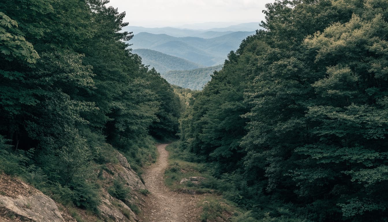
For an overnight or multi-day trip, research water sources, resupply options, campsites, and navigation well in advance. Access points can be far apart, and services may be limited along remote stretches. Use the Allegheny Trail’s interactive map and access information, and confirm current access before you leave. Carry a reliable map, even if you plan to use a phone, and have a backup route if conditions change.
Walk or ride sections of the Greenbrier River and North Bend trails
The Greenbrier River Trail and North Bend Rail Trail follow former railroad corridors, so their grades are generally gentler than those of steep mountain hikes. Both work well for an out-and-back walk: pick a trailhead, set a comfortable turnaround point, and retrace your steps when you’re ready.
The Greenbrier River Trail extends about 78 miles, so a short visit can cover just a small stretch. Check Greenbrier River Trail visitor information for current details, including access and permitted activities. The North Bend Rail Trail crosses north-central and western West Virginia; its state parks trail page offers information for planning a visit.
Conditions aren’t identical across either route. Surface, shade, facilities, allowed uses, and access points can vary by section, so check local trail information before setting out. If you’re arranging a shuttle or planning a longer walk, confirm where you can park and where the trail connects to public roads. A clear turnaround point helps keep the outing manageable, especially when services are sparse.
Plan around West Virginia’s changing seasons and mountain weather
The best time to hike in West Virginia depends on more than the calendar. Rain, elevation, and exposure can change footing and comfort quickly, so match your route to current conditions and check forecasts and local alerts shortly before leaving.
Know what spring, summer, fall, and winter bring
Spring brings fresh greenery and flowing streams, but melting snow and rain can leave trails muddy and stream crossings high. Low trails may be soggy while shaded slopes still hold ice. Wear shoes with reliable traction, and turn back if water is too deep or fast to cross safely.
Summer offers long daylight hours, yet heat and humidity can make climbs strenuous. Afternoon storms may bring lightning, heavy rain, and slick rocks, so start early and check the forecast before setting out. At higher elevations, exposed terrain can feel much colder and windier than nearby towns. Dolly Sods is especially open to the elements, so bring a warm layer even on a mild day.
Fall color draws more visitors to popular overlooks and trailheads. Arrive early to improve your chances of finding parking, and expect busy roads and crowded viewpoints during peak foliage weekends. Winter brings snow and ice, particularly at higher elevations, where conditions can differ from those in the valleys. Check for changing access and trail conditions before you commit to a route.
Check closures, trail conditions, and peak-season crowds
Trail access can change because of maintenance, storm damage, construction, or seasonal road conditions. Before driving out, review updates from the National Park Service at New River Gorge, West Virginia State Parks, and the Monongahela National Forest. These official pages can help you spot closures, alerts, and access changes, but conditions may shift after you check.
On busy fall weekends and summer holidays, start early at well-known overlooks and confirm parking details before leaving. Choose a backup trail in the same area in case a road, lot, or route is closed. Keep your plan flexible, especially if rain, wind, or high water changes the difficulty of the hike.
Pack well and hike safely in West Virginia’s backcountry
Remote routes reward good preparation, especially when rough footing, changing weather, and limited cell service make a quick change of plans harder. Pack for the hike you expect, leave someone a clear itinerary, and be ready to turn back if conditions shift.
Bring the essentials, even for a short hike
A short trail can take longer than expected when it climbs steeply or crosses wet, rocky ground. Carry water and snacks, plus a paper map or a map downloaded for offline use. A charged phone is useful, but reception may be unreliable in mountain hollows and remote forests, so don’t depend on it for navigation.
Also bring a light source, basic first-aid supplies, and layers suited to the forecast. Sturdy footwear helps on roots, loose rocks, and muddy sections; a rain jacket adds protection when showers arrive. Adjust water, food, and other supplies to the route length, weather, and needs of everyone in your group. The National Park Service’s hiking safety advice offers a useful reminder to plan ahead and carry what you need.
Before leaving, tell someone where you’re going, which route you plan to take, and when you expect to return. Agree on what they should do if you don’t check in. This simple plan matters most on hikes where phone service is spotty and trailheads are far from help.
Protect yourself, other hikers, and fragile places
Stay on marked trails, even when a shortcut looks easier. Wandering off route can damage plants and soil, and it makes navigation harder if the trail becomes unclear. Pack out all trash, including food scraps, and leave plants, rocks, and other natural features where you find them.
Give wildlife room to move, and never feed or approach animals. Keep dogs leashed where required, and check pet rules before heading out. On exposed overlooks, stay back from cliff edges; loose rock, wet ground, and sudden gusts can make a familiar viewpoint risky.
Rules vary across West Virginia parks, forests, and trail systems. Hunting seasons, fire restrictions, and pet policies may differ by location and time of year, so check the managing agency’s current regulations before your trip. Following Leave No Trace principles helps protect the places you came to enjoy.
Frequently Asked Questions
A little extra planning can make West Virginia hikes easier to enjoy, especially when conditions or access differ from what you expected. These answers cover common details to check before choosing a trail.
What is the best time of year to hike in West Virginia?
Each season offers a different experience, and the best time depends on your destination, the forecast, and what you want to see. Spring brings stronger waterfalls and fresh growth, but rain can leave trails muddy and streams high. Summer offers long days, though heat, humidity, and afternoon storms can make exposed routes uncomfortable.
Fall is popular for foliage, so expect more visitors at well-known overlooks and trailheads. Winter can bring quiet trails and snowy views, but ice, wind, and road conditions may limit access, especially at higher elevations. Check the local forecast and trail updates rather than relying on seasonal averages.
Are there beginner-friendly hiking trails in West Virginia?
Yes. State parks and trail systems include short walks, boardwalks, and gentler routes, but a trail’s name or reputation doesn’t tell you everything about its difficulty. Before leaving, check the distance, elevation gain, surface, stairs, and access details.
A short route can still feel strenuous if it climbs steeply or crosses slick rocks. For a first hike, choose a clearly marked trail with an easy turnaround point, then allow extra time to return.
Do I need a permit to hike in West Virginia?
Many day hikes don’t require a hiking permit, but rules vary by location and activity. Parking fees, overnight camping, backcountry stays, or access to a special area may involve separate permits or reservations.
Check the official managing agency’s current rules before your trip. For example, New River Gorge visitor information includes details about permits, reservations, and park conditions.
Can I bring my dog on West Virginia hiking trails?
Some trails allow dogs, while others restrict pets in certain areas or require a leash. Check the rules for your specific park or trail before you go; New River Gorge’s pet guidance explains its requirements.
Also consider whether your dog can handle the route’s length, steep sections, and surface. Hot weather, cold conditions, and rocky terrain can make a hike unsafe for a dog that isn’t fit for the outing.
Is cell service reliable on West Virginia trails?
Cell service can be limited or absent in remote mountain areas, so don’t rely on your phone for directions or emergency communication. Download an offline map before leaving, and carry a paper map or another backup navigation option.
Share your route, trailhead, and expected return time with someone before you go. That plan gives someone a clear starting point if you don’t return as expected.
Conclusion
West Virginia’s hiking trails offer a route for nearly every kind of outing, from a quick walk to a waterfall to a demanding climb through the highlands. The best hike is one that matches your ability, available time, and interests.
Before you go, check current trail conditions and weather, then leave the landscape as you found it. With a little planning, you can enjoy the state’s varied scenery at a pace that feels right for you.


