

Hiking Trails in Arizona: Red Rock Wonders & Canyon Treks
Arizona’s hiking trails shift from red-rock paths in Sedona to cool pine forests near Flagstaff, cactus-covered hills around Tucson, and the vast Grand Canyon. That variety makes every outing feel different, but trail difficulty, weather, and access can change dramatically across the state.
The right hike depends on where you’re staying, your fitness, the season, and the kind of day you want. Sedona’s Cathedral Rock and Devil’s Bridge offer striking red-rock scenery, while Humphreys Peak and the Grand Canyon call for more demanding preparation. The hiking trail guide ahead compares standout routes and shares practical advice to help you choose a trail that fits. Be sure to check out the RunDreamAchieve YouTube channel for weekly running tips.
Key Takeaways
- Hiking trails in Arizona span Sedona’s red-rock formations, Flagstaff’s pine forests, Tucson’s desert foothills, and the Grand Canyon.
- Choose a route based on your location, fitness, available time, and comfort with elevation gain or exposed terrain.
- Popular hikes such as Cathedral Rock and Devil’s Bridge can get crowded, so start early and check access conditions before you go.
- Arizona heat can make exposed trails dangerous, especially in summer; follow the National Park Service’s Grand Canyon hiking guidance and plan around the forecast.
- Carry enough water, wear suitable footwear, and confirm trail rules, closures, and conditions before setting out.
Hiking Trails in Arizona That Show Off the State’s Best Scenery
Arizona’s best hikes lead through canyon depths, sculpted red rock, pine forests, and saguaro-filled desert. The trails below are grouped by region, so you can match a route to your itinerary and experience level. Distances can change with the trailhead or loop you choose, and access conditions may change too, so check current local guidance before you go.
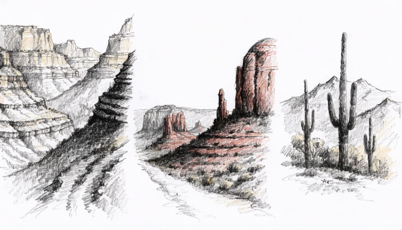
Grand Canyon hikes for big views and serious effort
The South Kaibab and Bright Angel trails both descend steeply from the South Rim, but their conditions differ. South Kaibab offers wide-open canyon views and little shade. It has no reliable water along the trail, so carry what you need. Bright Angel has resthouses and seasonal water services, but availability can change. Check the National Park Service’s current trail updates before leaving.
For a day hike, choose a turnaround point that leaves enough energy for the climb back up. The descent can feel easy at first, but every step down adds work to the return. Hiking to the Colorado River and back in one day is not a casual day hike. Heat, elevation loss, and fatigue make that route a serious undertaking.
Sedona trails through red rock country
Cathedral Rock is a short hike with a steep, rocky scramble near the top. Its red-rock ledges open onto broad views, but hikers need sure footing and comfort with exposed sections. Devil’s Bridge leads to one of Sedona’s best-known natural arches. Distance depends on the chosen trailhead, and popular access points can fill early.
For a cooler, shaded option, follow West Fork of Oak Creek through a forested canyon. The route crosses the creek several times, so expect wet feet and check conditions after rain. Sedona’s parking, shuttle access, route options, and permit rules can change. Review current local guidance, including Sedona Shuttle trailhead service information, before setting out.
Flagstaff and the high country’s forest trails
Around Flagstaff, ponderosa pine forests and cooler air offer a sharp contrast to the desert. Humphreys Peak is the demanding choice: the trail climbs toward Arizona’s highest point through forest, then continues above treeline into exposed alpine terrain. The Forest Service lists about 3,420 feet of elevation gain and warns that weather can turn severe. Check its Humphreys Trail conditions and details.
Altitude, storms, snow, and exposure make this climb different from a desert hike, even in warmer months. Start early, watch the forecast, and turn back if conditions worsen.
Phoenix-area hikes for a quick climb or desert outing
Camelback Mountain’s Echo Canyon route and Piestewa Peak Summit Trail offer strenuous climbs close to Phoenix. Echo Canyon includes steep, rocky sections, while Piestewa’s summit path has sustained uphill effort and expansive city views. Both trails are popular, and exposed slopes can become dangerously hot.
Begin early, carry enough water, and take care on loose or uneven footing. Their city location doesn’t make either route easy, especially in summer heat.
Tucson and Saguaro National Park’s cactus-lined routes
Saguaro National Park’s east and west districts show off distinct stretches of Sonoran Desert, with tall saguaros, rocky hills, and open mountain views. Wasson Peak, in the Tucson Mountains west of the city, makes a longer outing. Depending on the route, the hike ranges from about 3.4 to 8 miles, with broad views from the summit. The National Park Service lists Wasson Peak route options.
Rocky footing and limited shade call for sturdy shoes, ample water, and careful heat planning. Check the forecast and current park conditions before choosing your route.
Choose Your Distance, Duration and Goal Time
Make three quick selections and open the exact plan built for your race target.
Looking for a Fully Personalized Training Plan?
The training plans above are an excellent choice if they match your goal. However, if you’d rather train with a plan built specifically around your current fitness, goal race, preferred training days, weekly mileage, and target finish time, our RDA Custom Training Plans provide a personalized solution. We also have running courses available for runners seeking to run faster from the mile to the marathon.
Why Choose a Custom Training Plan?
| Standard Training Plan | RDA Custom Training Plan |
|---|---|
| Follows a fixed schedule | Built around your schedule |
| Standard weekly mileage | Peak mileage customized for you |
| Fixed workout days | Train on the days you choose |
| Same structure for everyone | Designed around your current fitness |
| Static plan | Updated as your fitness improves |
| One-time purchase | Ongoing personalized coaching and support |
What You’ll Receive
- A training plan built specifically for your goal
- Personalized training paces
- Long runs, tempo runs, threshold workouts, interval sessions, recovery runs, and easy runs
- Peak weekly mileage matched to your experience level
- Flexible training schedule that fits your life
- Ongoing plan adjustments as your fitness improves
Ready to Train Smarter?
Stop guessing and start following a plan built specifically for you, your schedule, and your racing goals.
How to Choose an Arizona Hike That Fits Your Day
The best hike is one you can enjoy at a steady pace and finish with enough energy for the trip back. Across Arizona, mileage alone can mislead: a short route with steep climbing, loose rock, or little shade may feel harder than a longer, gentler path. Compare the terrain and elevation with your available time, fitness, and comfort in the conditions.
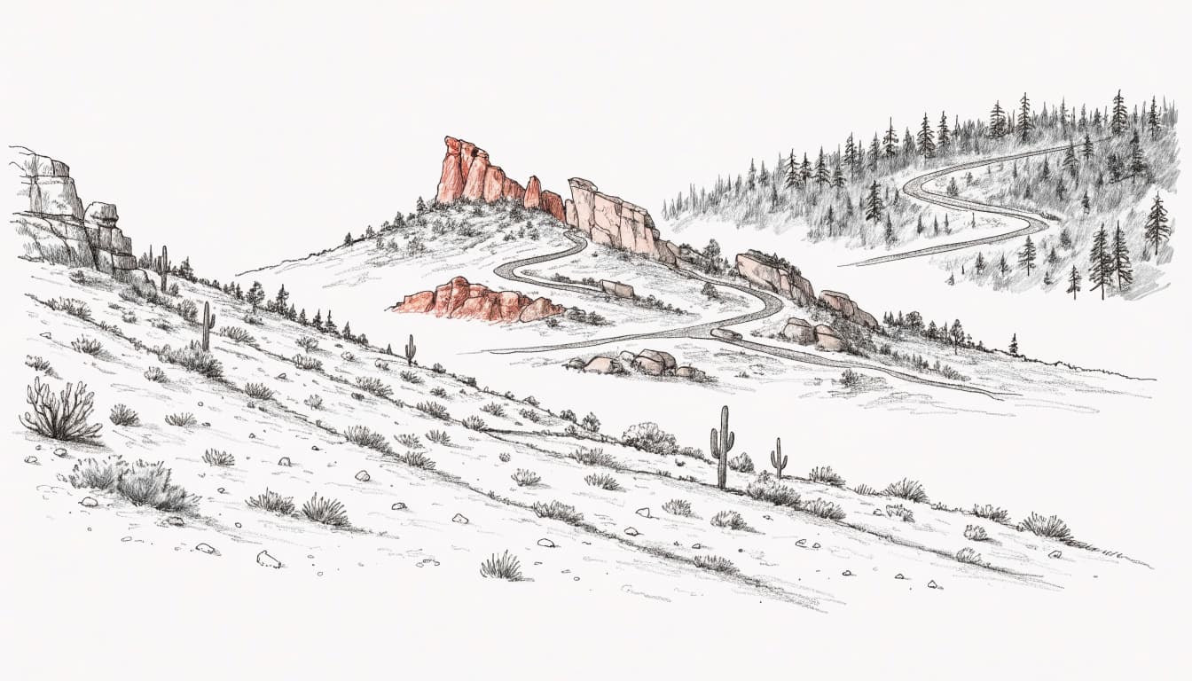
Match the trail to your fitness and comfort on rough ground
Before choosing a route, check its elevation gain, not just the distance. A steep climb can slow your pace and tax your legs, while high-altitude trails near Flagstaff may feel demanding even to fit hikers. Scrambling, uneven ledges, and loose rock also require balance and sure footing. If any of these sound uncomfortable, choose a less technical trail.
Heat exposure matters just as much. An open desert path can offer little shade, so the same mileage may feel far tougher in warm weather than beneath a forest canopy. If you’re new to desert hiking, start with a shorter route and see how your body responds. Build in time to rest, drink water, and turn back if the heat, footing, or your energy level becomes a concern.
A few broad categories can help set expectations:
- An easy nature walk usually follows a shorter, less demanding route with gradual terrain. It suits a relaxed outing or a day when you want time for stops.
- A moderate half-day hike often includes sustained walking, some elevation gain, or rougher sections. Allow extra time for breaks and the return.
- A strenuous climb may combine steep elevation gain, exposed terrain, scrambling, or high altitude. Choose one only if your fitness and experience match the demands.
These labels vary by trail and conditions, so read the route description closely. Set a turnaround time before starting, especially on an out-and-back hike. The route back still takes effort, even when the trailhead seems close.
Pick a hike near your base and check access details
A scenic trail can take up more of the day than expected if the drive is long or parking fills early. Start with your lodging or planned activities, then compare trailhead drive time with the hours you have. In Sedona, shuttle service affects access to popular trailheads; check the Sedona Shuttle’s current riding information before leaving. At the Grand Canyon, some trailheads require shuttle access, so confirm the route and schedule.
Also check whether the hike requires a permit, park entry fee, or advance reservation. Seasonal closures, road conditions, trailhead parking limits, and changing shuttle schedules can alter your plan. Review current rules shortly before your trip, rather than relying on an old itinerary.
Havasu Falls needs especially careful planning. The falls lie on Havasupai tribal land, and visitors need advance permission and arrangements before entering the reservation. It isn’t a public trail where you can simply arrive and walk in. Check the National Park Service’s Havasupai visitor information and reservation requirements before building it into your schedule.
When to Hike in Arizona, From Desert Spring to Snowy Peaks
Arizona’s hiking seasons depend on elevation as much as the calendar. A mild day in Phoenix can coincide with snow or ice near Flagstaff, so plan for the conditions at your specific trail rather than relying on the month alone.
Plan desert hikes around heat and daylight
Spring and fall are often comfortable seasons for lower-elevation hikes around Phoenix, Tucson, and Sedona. Temperatures tend to be milder than in summer, making it easier to spend time on exposed paths. Even then, check the forecast: warm spells can arrive early, and a sunny trail may offer little shade.
Summer heat can become dangerous quickly, especially on open desert routes. Start before sunrise when possible, carry enough water, and set a conservative turnaround time before you leave. Avoid exposed trails during the hottest part of the day. At Grand Canyon National Park, the National Park Service advises hikers to avoid hiking during the heat of the day. Treat that guidance seriously on steep, exposed routes, where climbing out can take far longer than descending.
Winter can bring pleasant hiking weather in the low desert, but cold mornings and changing conditions still call for layers and a forecast check. Spring and fall also have shorter daylight than summer, so leave enough time to finish before dark. On any season’s hike, turn back if heat, footing, or your pace makes the return uncertain.
Use cooler months wisely in the mountains
Higher elevations have a different season pattern. Around Flagstaff, winter and early spring can bring snow, ice, and cold conditions even while desert trails feel mild. Some mountain routes may be difficult or unsafe to reach, so check road access and local trail alerts before driving out.
Summer often offers cooler hiking weather at elevation, but it also brings the risk of thunderstorms. Exposed ridges and summit routes leave little shelter when storms build, so check the forecast before starting and be ready to change plans. The Grand Canyon weather and climate guide describes the region’s seasonal variation, while the park’s current forecast and road conditions help with day-of planning.
Fall can bring pleasant hiking conditions in the high country, but temperatures drop as daylight fades. In spring, snow and ice may linger on shaded trails after lower elevations have warmed. Conditions also vary from one mountain route to another, so pack for cold, wet weather whenever the forecast calls for it.
For hiking trails in Arizona, the forecast and local alerts matter more than the calendar. Check them close to departure, then choose a route that fits the actual conditions.
How to Prepare for an Arizona Hike and Stay Safe
A safe hike on Arizona trails starts before you reach the trailhead. Conditions can shift with elevation, heat, and storms, so match your gear and plans to the route, then stay ready to change course.
Pack for sun, water, changing weather, and rough terrain
The day before your hike, check the route, elevation, forecast, trail alerts, and access rules. Decide how far you plan to go and when you’ll turn around. Then use that plan to choose what to carry. There’s no single packing list for every Arizona hike, and trail water sources are limited or unreliable.
Before leaving, run through this checklist:
- Water: Carry more than you expect to need, based on the route, weather, effort, and your own needs. Don’t count on finding water along the trail.
- Food: Pack enough food for the planned outing, plus extra snacks. Salty foods can help replace salt lost through sweat.
- Sun protection: Bring a brimmed hat, sunglasses, and sunscreen. Choose clothing that covers exposed skin when practical.
- Footwear and layers: Wear sturdy shoes suited to rocky or uneven ground. Add a light layer or rain protection if the forecast calls for cooler temperatures, wind, or storms.
- Navigation and communication: Download an offline map or carry a paper map, and bring a charged phone. A small battery pack can help, but cell service may be unavailable on remote trails.
- Emergency readiness: Carry a basic first-aid kit and a light source. Tell someone your route, start time, and expected return, and agree on when they should check in or seek help if you’re overdue.
On hike day, check the forecast and alerts again. If conditions have changed, choose a safer route or postpone the outing.
Know when to turn back or change your route
Set a turnaround time before you start, and stick to it even if you haven’t reached the viewpoint. Heat that rises faster than expected, building storms, unusual fatigue, dizziness, poor footing, or dwindling water all call for a change of plan. Stop in a safe place, assess how you feel, and head back if continuing would leave too little time or energy for the return.
Turning around early is a sound decision, especially on steep trails. The descent may feel easy, but the climb back can take longer and demand more effort. If anyone in your group feels confused, weak, nauseated, or unsteady in the heat, stop and seek help as needed rather than pressing on.
Respect Arizona’s land, wildlife, and other hikers
Stay on marked trails to reduce erosion and protect fragile desert plants. Pack out all trash, give wildlife space, and never feed or approach animals. Follow posted instructions and current rules from the managing agency, including park, tribal, and local authorities. Access requirements differ by location, so check them before setting out.
Canyons and washes can flood quickly when storms send water downhill, even if rain isn’t falling where you’re hiking. Avoid entering narrow canyons or washes when storms threaten, and leave if water rises or flows begin. The National Park Service’s Grand Canyon weather guidance explains the danger of distant thunderstorms, while the National Weather Service’s monsoon safety advice covers Arizona storm hazards. When the forecast raises concern, choose a route outside drainages or postpone the hike.
Frequently Asked Questions
Arizona hikes can look very different on a map than they feel underfoot. These answers cover a few practical details to check before choosing a route and heading to the trailhead.
What is the best time of year to hike in Arizona?
There isn’t one best hiking season across the state. Lower desert routes around Phoenix and Tucson are often more comfortable in cooler months, while higher-elevation trails near Flagstaff can bring snow and ice in winter and spring. In summer, mountain routes may offer cooler conditions, though storms can develop. Choose based on the trail’s elevation, local forecast, and current alerts.
Are Arizona hiking trails suitable for beginners?
Yes. Many Arizona trails are short and well marked, but distance alone doesn’t show how demanding a route will feel. Heat, little shade, rocky footing, steep climbs, and altitude can challenge new hikers, even on a brief outing. Start with a short route that matches your comfort and fitness, then check its terrain and current conditions before you go. Saguaro National Park also provides trail accessibility details for some routes.
How much water should I bring on an Arizona hike?
Your water needs depend on heat, distance, pace, elevation, and how your body responds to exertion. Carry ample water for the planned hike, with a margin for delays, and don’t assume a fountain or trail refill station will be working. Before leaving, check current guidance from the agency that manages your route, especially for long, exposed hikes.
Do I need permits to hike in Arizona?
Permit and reservation rules depend on the trail and who manages the land. Havasu Falls is a notable example: visitors need advance permission to enter Havasupai lands, so don’t treat it as a walk-up day hike. For any route on your itinerary, check current rules, fees, and access details with the relevant park, tribal authority, or land manager.
Can I hike in Arizona during summer?
Yes, summer hikes can be possible, particularly at higher elevations, but exposed desert routes carry serious heat risk. Check the forecast, start early, and choose a route with conditions you can manage. If temperatures are unsafe or storms threaten, change plans or postpone the hike rather than relying on an early start alone.
Can I bring my dog on Arizona hiking trails?
Rules vary by trail, park, and land manager, and some popular routes prohibit pets. For example, dogs aren’t allowed on the upper trails through the rocks at Echo Canyon. Check the specific trail’s pet rules before bringing your dog, and consider the heat and rough ground, which can be hard on paws. Saguaro National Park lists current pet rules for its trails and facilities.
Conclusion
Arizona’s hiking trails offer a route for nearly every kind of day, from a short climb over Sedona’s red rocks to a full outing in the pines or canyon country. The best choice matches your fitness, time, and comfort with the terrain.
Before you go, check current access and weather, then prepare for heat, water needs, and conditions that can change along the way. Choose a trail that fits the day, and enjoy Arizona’s scenery with care for the land and the people who share it.


