

Denver Colfax Marathon Road Closures Guide
Race morning in Denver arrives with a different rhythm. Thousands of runners fill Colfax Avenue and surrounding streets, while barricades, police officers, volunteers, and course crews redirect traffic around the race route. For drivers, residents, hotel guests, and spectators, familiar routes can change before sunrise and remain restricted until runners pass and crews remove course equipment.
The denver colfax marathon road closures vary each year based on the event distance, course segment, start and finish areas, and cleanup progress. A street may close for the marathon, reopen for a period, then face another restriction as a later race event moves through. Use this guide to plan your trip, but confirm exact closure times and current conditions with the official Colfax Marathon website and the City and County of Denver before you travel.
You’ll find practical details on when closures begin and end, which neighborhoods and roads are affected, and how to adjust your driving, parking, and public transit plans. We’ll also cover pedestrian access, alternate routes, and race-day choices that can help you reach your destination with less stress. First, let’s look at how closure timing works across the course.
Make sure to book your Denver Colfax Marathon hotels well in advance to save on higher prices later.
Build Your Running Performance System
Move from research to action with training, recovery, nutrition, pacing, and performance tools built for runners.
More Guides for This Runner Goal
Key Takeaways
- Denver Colfax Marathon road closures occur on a rolling schedule, with affected streets typically restricted between 5 a.m. and 1 p.m.
- Check the official Colfax course map before leaving, because closure times vary by neighborhood and race segment.
- Plan extra time for detours, blocked intersections, parking restrictions, and delayed access to homes, hotels, and businesses.
- I-25 remains an important north-south option, but nearby exits and surface streets may still experience congestion.
- Runners, drivers, and spectators should confirm race-day updates before traveling, then follow police, volunteer, and barricade directions.
When Do Denver Colfax Marathon Road Closures Start and End?
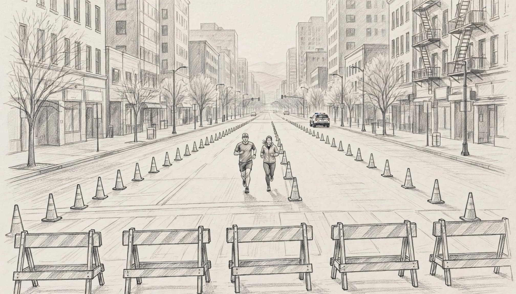
Denver Colfax Marathon road closures usually begin before the first runners reach each street. Race crews need time to place barricades, cones, signs, timing equipment, and aid stations. Police officers and traffic-control teams also need a clear route before the starting waves move through the city.
Most affected roads close between 5 a.m. and 1 p.m., but the timing changes by location. The official Colfax course map and closure information explains that streets close on a rolling schedule, not all at once.
Why roads close before runners arrive
Early closures create a protected corridor for runners, volunteers, medical staff, and race vehicles. They also give crews enough time to manage intersections safely, especially near the start line, major turns, bridges, and narrow sections of the course.
A street can feel empty at 5 a.m., yet still require a full closure. Crews may be unloading equipment, checking barricades, setting up water stations, or preparing a crossing point for runners. Opening the road too soon could put workers and participants in the same traffic space.
Race-day restrictions also vary by event. The marathon, half marathon, Urban 10 Miler, and 5K use different routes and may affect different neighborhoods. A road that remains open during one race could close during another.
How Denver road closures reopen
Streets reopen in stages after the final runner, cyclist, and support vehicle pass through an area. Crews still need to remove barricades, collect cones, clear aid stations, and confirm that police can release traffic safely. As a result, a road may remain restricted after the course appears quiet.
The main types of race-day restrictions include:
- Full closures, which stop vehicles from entering a section of the course.
- Rolling closures, which move along the route as runners advance.
- Lane restrictions, which leave part of a road open while the race uses the remaining lanes.
- Police-held intersections, where officers temporarily stop traffic even when nearby streets remain open.
- Setup and cleanup restrictions, which can begin before the race or continue after runners pass.
A route may also reopen briefly before another race segment creates a second delay. That makes posted windows more useful than guessing based on the scheduled start time.
Plan for the entire closure window, not only the minutes when runners are visible.
How to plan around the closure window
If your trip crosses the Colfax course, leave extra time and avoid relying on a single access point. Check whether you can approach your destination from another direction, and allow room for a detour if police hold an intersection.
Before leaving, compare the official course map with current Denver 311 updates, street closure notices, and local transportation alerts. Transit routes can also change when buses or rail lines approach the race area. Local coverage has previously reported rolling closures and impacts to routes near the W Line, Colfax Avenue, and surrounding streets, so check for updates on race morning.
I-25 may remain a useful north-south option, but nearby exits and surface streets can still become congested. Build your plan around the specific neighborhood you need to reach, then confirm conditions shortly before departure.
Which Denver Streets and Neighborhoods Are Affected?
The Denver Colfax Marathon creates a moving corridor through several parts of the city rather than one citywide shutdown. The traditional route connects areas near City Park, East Colfax, downtown Denver, west Colfax, and Sloan’s Lake, but the exact course and closure boundaries can change each year.
Use the current official Colfax Marathon course map as your primary planning tool. It shows where the race travels, which intersections runners cross, and how the course may affect access to homes, hotels, businesses, and nearby parking.
The broad route footprint
Race activity often begins near City Park, where runners gather and the opening roads close early. Streets around the park may experience heavier restrictions because they handle the start area, staging vehicles, spectators, and the first miles of the course.
From there, the route traditionally follows or approaches East Colfax. Businesses, residences, side streets, and bus stops near the avenue can see different levels of disruption depending on the year’s race layout. Some roads may face a full closure, while others remain open with police-controlled crossings or limited lane access.
The course then reaches downtown Denver, where major intersections can affect trips that never use Colfax Avenue itself. A nearby cross street may remain open for much of the morning, but officers could pause traffic when runners pass. Downtown parking garages and hotel entrances also deserve special attention because the nearest approach may be blocked.
West of downtown, the race traditionally extends toward west Colfax and Sloan’s Lake. These areas can experience rolling restrictions as the field spreads out and later race events move through. A road that opens after the leading runners pass may close again when another portion of the event reaches the same area.
Choose Your Distance, Duration and Goal Time
Make three quick selections and open the exact plan built for your race target.
Looking for a Fully Personalized Training Plan?
The training plans above are an excellent choice if they match your goal. However, if you’d rather train with a plan built specifically around your current fitness, goal race, preferred training days, weekly mileage, and target finish time, our RDA Custom Training Plans provide a personalized solution. We also have running courses available for runners seeking to run faster from the mile to the marathon.
Why Choose a Custom Training Plan?
| Standard Training Plan | RDA Custom Training Plan |
|---|---|
| Follows a fixed schedule | Built around your schedule |
| Standard weekly mileage | Peak mileage customized for you |
| Fixed workout days | Train on the days you choose |
| Same structure for everyone | Designed around your current fitness |
| Static plan | Updated as your fitness improves |
| One-time purchase | Ongoing personalized coaching and support |
What You’ll Receive
- A training plan built specifically for your goal
- Personalized training paces
- Long runs, tempo runs, threshold workouts, interval sessions, recovery runs, and easy runs
- Peak weekly mileage matched to your experience level
- Flexible training schedule that fits your life
- Ongoing plan adjustments as your fitness improves
Ready to Train Smarter?
Stop guessing and start following a plan built specifically for you, your schedule, and your racing goals.
How to read the current course map
Don’t study the map only for the bold race line. Trace the roads surrounding your destination and identify the nearest crossing points before race morning.
Check these details:
- Find the section of the course closest to your home, hotel, workplace, or parking garage.
- Look for nearby parallel roads, then confirm whether they cross the route or run alongside it.
- Identify legal crossing points instead of assuming every intersection will remain open.
- Follow the direction of travel, because runners may approach a street from a different direction than expected.
- Check whether the map shows separate routes for the marathon, half marathon, Urban 10 Miler, and 5K.
- Allow extra time if your trip depends on a single bridge, avenue, or downtown entrance.
The closest open street is not always the best detour. A parallel road can still lead directly into a police-held intersection.
Why neighborhood impacts vary
City Park and East Colfax may feel the earliest disruption, while downtown and Sloan’s Lake may see restrictions later in the morning. West Colfax can also experience changing access as runners move through and crews remove barricades behind them.
Because closures occur on a rolling schedule, residents should plan around the full posted window rather than the expected arrival of the first runner. Local reporting from 9NEWS race-day coverage can add useful context, but the official map remains the best source for crossings and route boundaries. Recheck it before leaving, then follow barricades and traffic officers even when a familiar road appears clear.
How to Get Around Denver During the Marathon
Getting around Denver during the Colfax Marathon requires more than choosing the fastest route. The course can divide familiar neighborhoods, delay crossings, and make a nearby destination feel surprisingly far away. Choose your travel method based on your starting point, destination, and the streets closed between them.
Driving and parking during the race
Driving works best when you stay outside the closure zone and approach your destination from an open side. Before leaving, compare your route with the official Colfax course map, then check whether your route crosses the course or depends on a police-controlled intersection.
Parking garages may remain open, especially downtown, but an open garage doesn’t guarantee easy access. The entrance could sit on a closed street, face a blocked turn, or require a long detour. Hotel guests should ask the front desk about the best approach, loading zones, and whether vehicles can leave during the morning.
When practical, park outside the race zone and walk the remaining distance. That approach is often more reliable than trying to cross the course several times. Workers should also arrive early, carry any needed access information, and avoid assuming a familiar employee entrance will remain reachable.
A garage can be open while its most convenient entrance is impossible to reach.
Walking, biking, and rideshare
Walking is often the simplest option for short trips inside the closure area. Use sidewalks and designated crossings, follow volunteer directions, and leave extra time for crowded corners near the start, finish, spectator areas, and aid stations. Runners should also remember that the most direct route to the start or post-race meeting point may require a longer walk around barricades.
Biking can shorten trips, but the course may interrupt familiar bike routes. Stay off the race route unless officials permit access, and avoid locking a bicycle to temporary barricades or event equipment. A bike can help with the outer part of a trip, followed by walking near the course.
Rideshare vehicles face the same barriers as private cars. Drivers may need to stop outside the closure area, and pickup locations can shift when streets close. Set a meeting point on an open cross street rather than requesting a drop-off directly beside the course. Spectators should confirm the pickup location before the race gets busy, because crowded sidewalks can make last-minute changes difficult.
Using RTD and planning transfers
Public transit may be a strong choice, but don’t assume buses and trains will follow their normal paths. RTD can detour buses, adjust stop locations, and delay service near the course. Its Colfax Marathon notice has described temporary detours and delays during race hours, while the RTD service alerts page provides current updates before travel.
Check your route shortly before departure, especially if you need a transfer. Allow additional time for walking between a temporary stop and your destination, and keep a backup option available if a bus cannot reach your usual stop. Light rail may avoid some surface-street closures, yet stations, sidewalks, and connecting buses can still experience race-day congestion.
For most travelers, the safest plan is simple: park outside the closure zone, walk when the distance is reasonable, and use current RTD information instead of relying on a normal Sunday schedule. Factor in the return trip too, because roads and transit routes may change again while crews clear the course.
Planning Race Morning Around Colfax Marathon Traffic
Race morning works best when you plan movement before the streets fill. Denver Colfax Marathon road closures can affect your drop-off point, warmup route, bag check, bathrooms, meeting locations, and trip home. Runners and spectators should build a plan around walking access, not a last-minute car ride.
The official marathon course overview shows the route and major course sections. Review it with your start location, parking plan, and spectator schedule before race morning.
Runners should arrive with time to spare
Avoid depending on a rideshare or family drop-off at the start line. A driver may reach the neighborhood but still face a barricade, a police-held intersection, or a closed approach road. Choose a legal drop-off point outside the closure zone, then walk the final distance.
Arrive early enough to handle several small delays without rushing. You may need extra time to find:
- The correct entrance to the start area.
- Bag check and gear storage.
- Portable bathrooms and water stations.
- Your corral, wave, or assigned gathering area.
- A calm place for a short warmup.
Keep your warmup close to the start area and avoid crossing the race route repeatedly. Once runners begin moving, barricades and volunteers may limit access between neighborhoods. The full course map and closure information can help you identify streets that may block your planned approach.
Pack only what you need after checking the event’s current bag-check rules. If you check a bag, confirm the pickup location before leaving the start area. Your route home may differ from your route in, especially if crews are still clearing streets.
Spectators need fixed viewing plans
Spectators should choose one or two viewing locations that can be reached without crossing closed roads. A nearby intersection may look convenient on a map, yet become inaccessible when runners, barricades, and traffic officers occupy the course.
Pick locations near open sidewalks, public transit stops, or a walking route from your parking area. If you want to see the same runner twice, choose points that sit on the same side of the course or connect through streets outside the closure zone. Avoid building a schedule that requires crossing Colfax Avenue or another major race road between sightings.
Meeting points also need a backup. Set one location outside the busiest spectator area, and share it before the race begins. Cell service and crowd movement can make last-minute coordination difficult.
A good spectator plan limits movement. Two reachable viewing spots are better than four locations separated by closed streets.
Night-before and race-morning checklist
Use this short checklist before traffic becomes part of the race:
- Review the official Colfax Marathon website for transportation, start-area, and race-day updates.
- Save your drop-off point, parking location, bag-check details, and meeting place.
- Check the course map for road closures between your lodging and the start.
- Set out shoes, bib, clothing, nutrition, identification, and any required gear.
- Leave early enough to walk around a closure instead of waiting for a crossing.
- Confirm your trip home, including where your ride can legally meet you.
- Follow volunteers, police officers, and posted barricades even when a familiar road appears open.
After the finish, expect tired legs and slower movement. Keep water, a charged phone, and a clear pickup plan available, then allow extra time for the course to reopen.
How to Check Live Closure Updates and Make a Backup Plan
Denver Colfax Marathon road closures can change as race crews, runners, police, and cleanup teams move through the city. A map saved weeks ago may show the right course but miss a new access restriction, transit detour, or updated reopening time. Check current information before you leave, then prepare a second way to reach your destination.
Follow the most reliable updates first
Start with the official Colfax Marathon website and any race-week emails sent to registered runners, volunteers, or participants. Check the year, race date, distance, and publication or update time before trusting the information. The official full course map and closure details explain the general closure window, but race-week notices can provide newer instructions.
Next, review updates from the City and County of Denver, Denver 311, Denver Police, and city transportation agencies. These sources may share street restrictions, traffic-control changes, parking limits, or emergency access information. If a social post shows a screenshot without a date, location, or race distance, treat it as unverified.
Local reporting can help explain how closures affect travelers across the city. For example, CBS News Colorado’s closure report can add useful context, but official race and city notices should guide your final decision. Reputable local news is a second set of eyes, not a replacement for current event information.
Transit riders should also check RTD service alerts before heading out. A bus may detour while rail service continues, or a familiar stop may move outside the closure area.
Build Plan A and Plan B before race morning
Your primary plan should name the exact starting point, destination, travel method, parking location, and expected arrival time. Then create a backup that changes at least one major part of the trip.
- Driving: Plan A might use a garage outside the course zone. Plan B could use a different garage, a legal drop-off point, or parking near a transit station.
- Transit: Plan A may use your usual bus or rail route. Plan B should identify another station, a replacement bus, or a walking route from a stop outside the closure.
- Family meetings: Choose a primary meeting place away from the start, finish, and busiest intersections. Set a second location on the same side of the course so nobody must cross a barricaded street.
- Getting home: Save a return route before the race begins. Your outbound path may reopen later, but crews could still block the nearest exit after you finish.
Google Maps and Apple Maps can show live traffic, delays, and broad congestion patterns. However, neither app may reflect every temporary barricade immediately. Compare app directions with official notices, then follow police officers, volunteers, and posted signs when they conflict with an estimated arrival time.
Frequently Asked Questions
Denver Colfax Marathon road closures can raise practical questions that a course map doesn’t answer. These quick answers cover common situations involving crossings, parking, emergency access, and last-minute travel changes.
Can I drive across the marathon course?
Usually, you should expect delays or a temporary stop at intersections along the route. Police officers may allow vehicles through designated crossings when a safe gap appears, but runners, bicycles, and support vehicles have priority during active race periods. Never drive around barricades or follow another car through a restricted crossing.
Will I be able to reach my home or hotel during the race?
Access depends on the street, closure type, and direction of travel. Residents and hotel guests may need to approach from a different side or park outside the restricted area, even when the building itself remains open. Contact your hotel or property manager before race morning if you need a guaranteed departure window.
Is I-25 open during the Colfax Marathon?
I-25 typically remains available as a north-south route, but nearby exits can feed into congested or closed surface streets. Check the final approach rather than assuming the highway solves the entire trip. Local reports, including 9NEWS closure updates, can provide additional race-day context.
Can I park near the start or finish line?
Parking near the start or finish may fill early, face temporary restrictions, or become difficult to reach after streets close. Use a confirmed garage or legal street space outside the course zone, then walk the remaining distance. Review the official course map and closure information before choosing a parking location.
What should I do if GPS directs me through a barricade?
Treat the barricade and traffic officer as more reliable than a navigation app. GPS data may not update quickly enough for temporary race restrictions, rolling closures, or police-held intersections. Stop in a legal location, select a route around the closure, and avoid making sudden turns near runners or spectators.
How can I get emergency help during a road closure?
Call 911 for an emergency and provide your exact address, intersection, or nearby landmark. Race staff and police maintain access plans for emergency vehicles, so don’t move barricades or attempt to create a private route. If you have a medical appointment, mobility concern, or time-sensitive need, arrange transportation in advance and ask the destination for access instructions.
Conclusion
Denver Colfax Marathon road closures are temporary, but their reach can extend across a large part of the city. Runners chasing a strong performance should arrive early, protect their warmup time, and plan every trip around the start and finish areas. Residents, visitors, and workers can reduce delays by avoiding repeated course crossings, choosing an approach from outside the closure zone, and keeping a backup route ready.
The strongest plan combines patience with current information. Check the latest official closure map, review RTD transit alerts, and allow extra time for barricades, police-controlled intersections, and cleanup. Whether you’re focused on a personal best or simply trying to reach your destination, a clear race-day route makes Denver easier to cross. Verify the most recent closure and transit updates before heading out.


